Wednesday, July 31, 2013

Hawaiian Citizenship


Who are Hawaiian Citizens and Hawaiian Subjects?

"Nationality" means the legal bond between a person and a State and does not indicate the person's ethnic origin.  Everyone has the right to a nationality.  (European Convention on Nationality)

One of the earliest laws in Hawaiʻi dealt with citizenship (nationality - not ethnicity;) it was part of King Kamehameha III’s Statute Laws 1845-1846.  The Chapter for that law was headed: “Of Subjects and Foreigners” and the specific Article was labeled “Aliens, Denizens and Natives.”

Following is the law concerning Hawaiian citizenship, part of King Kamehameha III’s Statute Laws 1845-1846 (first, the original law in Hawaiian; then, the English translation:)

Pauku 3. O na kanaka a pau i hanau malalo o ka malu o keia Aupuni, ina na na makua o ke Aupuni e, a ina na haole hoohiki i kanaka Hawaii, a ina na na kanaka maoli, a me ka poe i hanau ma ka aina e, ina no keia Aupuni na makua, a mahope hele mai na keiki e noho haanei, e manaoia kela poe a pau, he aie i ka hoolohe i ka Moi, ke alii ka lakou ma ka hanau ana, a e kau no ke kanawai o keia Aupuni maluna o lakou. o na kanaka a pau i hanau ma na aina e, ina no ka aina e na makua, a hoohiki ole hoi e like me ka olelo iloko o keia haawina alaila. e manaoia lakou he lahui e, a e hanaia'ku lakou e na'lii o keia Aupuni pela, e like nae me ka olelo o ke kanawai.

Section III. All persons born within the jurisdiction of this kingdom, whether of alien foreigners, of naturalized or of native parents, and all persons born abroad of a parent native of this kingdom, and afterwards coming to reside in this, shall be deemed to owe native allegiance to His Majesty. All such persons shall be amenable to the laws of this kingdom as native subjects.  All persons born abroad of foreign parents, shall, unless duly naturalized, as in this article prescribed, be deemed aliens, and treated as such, pursuant to the laws.  (Ka Huli Ao Digital Archives – Punawaiola-org)

Hawaiʻi followed the Anglo-American common law rule of “jus soli;” those born in the country and subject to its jurisdiction is a citizen. The common law rule traces back to the Norman Conquest of England in 1066.

Subsequent interpretation of the laws and practices affirmed who were Hawaiian citizens and what rights and obligations they possessed.

In 1850, HW Whitney, born in Hawaiʻi of foreign parents, asked the Minister of the Interior, John Young II, about his status. The question was referred to Asher B Bates, legal adviser to the Government, who replied that, “not only the Hawaiian Statutes but the Law of Nations, grant to an individual born under the Sovereignty of this Kingdom, an inalienable right, to all of the rights and privileges of a subject.”  (Hanifin)

In 1856, the Kingdom’s Supreme Court decided Naone v. Thurston, recognizing that persons born in Hawaiʻi of foreign parents were Hawaiian subjects.

On January 21, 1868, the Minister of the Interior for the Hawaiian Kingdom, His Excellency Ferdinand Hutchison, stated the criteria for Hawaiian nationality:
“In the judgment of His Majesty’s Government, no one acquires citizenship in this Kingdom unless he is born here, or born abroad of Hawaiian parents, (either native or naturalized) during their temporary absence from the kingdom, or unless having been the subject of another power, he becomes a subject of this kingdom by taking the oath of allegiance.”

With respect to ‘Native Subjects,’ another early document (Resolution by King Kamehameha III, dated June 28, 1847,) from Ka Huli Ao Center for Excellence in Native Hawaiian Law, William S. Richardson School of Law, notes in its English translation of the original Hawaiian text that “na kanaka maoli” translates to “native subjects.”

The Hawaiian version of that resolution starts: “No ka mea, ua oi aku ka waiwai paa iloko o na Kulanakauhale o keia Aupuni no ka lawe ana mai o na haole i ko lakou dala, a me ka lakou hana ana maanei, a no ka mea hoi, ua makemake ka Poe Ahaolelo o ka Moi, e haawi aku ia poe haole i na pono a me na pomaikai a pau e hiki ai me ka poino ole o na kanaka maoli …”

The English translation the text as: “Whereas, The value of real estate in the principal towns of the Hawaiian Kingdom, has been greatly increased by the outlay of the capital of foreigners: and Whereas, It is the desire of His Majesty's government to bestow every favor and privilege upon such foreigners not inconsistent with the best interests of the native subjects …”

Subsequent laws through the Republic, Territory and State provide that "All persons born or naturalized in the Hawaiian Islands, and subject to the jurisdiction of the Republic, are citizens thereof."

The text and translation of documents here are from Ka Huli Ao Center for Excellence in Native Hawaiian Law, William S. Richardson School of Law.  

The image shows what is often described as the Kānaka Maoli flag and is used today as a symbol for Hawaiian sovereignty.

Follow Peter T Young on Facebook  

Follow Peter T Young on Google+  

© 2013 Hoʻokuleana LLC

Tuesday, July 30, 2013

Ka Liona Hae O Ka Pakipika


A busy life … Teacher, Noble, Legislator, Newspaper Publisher, Italian Military Trainee, Surveyor, Revolutionist, Royalist, Counter-Revolutionist, Prisoner, Home Rule Candidate, Hawaiʻi’s First Congressional Delegate … he died October 23, 1903, at the age of 48.

He was born February 15, 1855 on the island of Maui. Hapa - his father was a native of Newport, Rhode Island; his mother, a native of Maui, a descendant of royalty.

He first went to school at Wailuku at the age of 8 years. When he was 10 years old his mother died, then his father moved to ranching at Makawao. There was no English school at Makawao until 1869.

That year, the Board of Education established the Haleakalā Boarding School; he was one of the first students at that school.  Upon completion of his studies, he became a teacher at ʻUlupalakua.

In 1880, he was elected to the Islands’ legislature; he represented the citizens of Wailuku and its neighboring Maui community.

Nicknamed Ka Liona Hae O Ka Pakipika, or "The Roaring Lion of the Pacific," Robert William Wilcox was a revolutionary soldier and politician – he was also referred to as the “Iron Duke of Hawaiʻi.”

King Kalākaua sent Wilcox to Italy to receive military training at the Royal Military of Turin, at the expense of the Hawaiian government.

In 1885, he graduated from the academy and was promoted to sub-lieutenant of the artillery; he then entered in the Italian Royal Application School for Engineer and Artillery Officers.  (Several of the old photos of Wilcox show him in his Italian uniform.)

There, he married the first of his two wives, Signorina di Sobrero, an Italian.

Wilcox stayed in Italy until 1887; he returned to the Islands that year, because of the constitutional changes that had happened at that time (Bayonet Constitution.)

Later, he and his wife moved to San Francisco in 1888 and he worked as a surveyor for the Spring Valley Water Works Co.  Wilcox came back to the Islands in 1889 and his wife returned to Italy.

On July 30, 1889, Wilcox led a rebellion to restore the rights of the monarchy, two years after the Bayonet Constitution of 1887 left King Kalākaua a mere figurehead.

By the evening, he became a prisoner and charged with high treason by the government.  He was tried for treason, but was acquitted by the jury.

In 1890, he was elected to the Legislature in the Islands.

Following the overthrow of Queen Liliʻuokalani in 1893, the Committee of Safety established the Provisional Government of Hawaiʻi as a temporary government until annexation by the United States.

The Provisional Government convened a constitutional convention and established the Republic of Hawaiʻi on July 4, 1894. The Republic continued to govern the Islands.

From January 6 to January 9, 1895, in a “Counter-Revolution,” patriots of the Kingdom of Hawaiʻi and the forces that had overthrown the constitutional Hawaiian monarchy were engaged in a war that consisted of battles on the island of Oʻahu.

It has also been called the Second Wilcox Rebellion of 1895, the Revolution of 1895, the Hawaiian Counter-revolution of 1895, the 1895 Uprising in Hawaiʻi, the Hawaiian Civil War, the 1895 Uprising Against the Provisional Government or the Uprising of 1895.

In their attempt to return Queen Liliʻuokalani to the throne, it was the last major military operation by royalists who opposed the overthrow of the Kingdom of Hawaiʻi.  The goal of the rebellion failed.

Wilcox was court-martialed and sentenced to death, but the sentence was commuted to thirty-five years.  While in prison in 1895, Pope Leo XIII granted an annulment of their marriage.  The Italian Consul and the Catholic Bishop at Honolulu confirmed this action.

In January, 1896, he was given a conditional pardon and became a free man; later that year, Wilcox married again, this time to Mrs. Theresa Cartwright.  In 1898, President Dole gave him a full pardon.

With the establishment of Territorial status in the Islands, Hawaiʻi was eligible to have a non-voting delegate in the US House of Representatives.

Wilcox and others formed the Independent “Home Rule” Party and Wilcox ran as a candidate for the Delegate position (against Republican Samuel Parker and Democrat Prince David Kawānanakoa.)  Wilcox won, and served as the first delegate and representative of Hawaiʻi in the US Congress.

He ran for re-election, but lost to Republican Prince Jonah Kūhiō Kalanianaʻole Piʻikoi (Prince Kūhiō served from 1903 until his death in 1922.)

Wilcox returned to Washington to finish out his term (November 6, 1900 to March 3, 1903,) but was very ill.  He came back to Hawaiʻi in 1903, and died October 26, 1903.  He is buried in the Catholic cemetery on King Street.

The image shows a statue of Robert Wilcox at Fort Street Mall and King Street in downtown Honolulu.  In addition, I have included other related images in a folder of like name in the Photos section on my Facebook and Google+ pages.

Follow Peter T Young on Facebook  

Follow Peter T Young on Google+  

© 2013 Hoʻokuleana LLC

Monday, July 29, 2013

Hale Pili


Traditional dwellings (hale pili) were constructed of native woods lashed together with cordage most often made from olonā. Pili grass was a preferred thatching that added a pleasant odor to a new hale. Lauhala (pandanus leaves) or ti leaf bundles called pe‘a, were other covering materials used.

There were many loina (rules) associated with the construction of hale. The kahuna ku‘iku‘i puʻuone, priest who chose the location for a hale, had the final word on the important decision of site selection. The building of a new house was marked with ritual and a feast of dedication.  (Bishop Museum)

The “birthing” ceremony of a new dwelling centered around the doorway of the house with the cutting of the piko (center, symbolizing the umbilical cord) of the house and offerings of fish. The kahuna o Lono recited a Pule Ho‘ola‘a Hale (House Dedication Prayer).   (Bishop Museum)

During a tour of the Island of Hawaiʻi in 1823, missionary William Ellis noted the following, “The houses of the natives whom he had visited today, like most in this part of the island [Hilo district], where the pandanus is abundant, were covered with the leaves of this plant, which, though it requires more labour in thatching, makes the most durable dwellings.”

There is also less variety in the form of the Sandwich Island dwellings, which are chiefly of two kinds, viz., the kale noho (dwelling house), or halau (a long building) nearly open at one end, and, though thatched with different materials, they are all framed in nearly the same way.”  (Ellis)

“The size and quality of a dwelling varies according to the rank and means of its possessor, those of the poor people being mere huts, eight or ten feet square, others twenty feet long, and ten or twelve feet wide, while the houses of the chiefs are from forty to seventy feet long.  (Ellis)

Unlike our housing today, the single ‘hale’ was not necessarily the ‘home.’ The traditional Hawaiian home was the kauhale (Lit., plural house;) this was a group of houses forming the homestead – spatially separated - each serving a specific purpose, but paired male and female activity areas.

“Their houses are generally separate from each other: even in their most populous villages, however near the houses may be, they are always distinct buildings.”  (Ellis)

A kauhale could consist of a cluster of dwellings in the mid-elevations for cultivating food, another cluster of dwellings on the shoreline for fishing, and perhaps even more higher up on the volcanic slopes for hunting and harvesting wood products.

For the fairly well-to-do family, these consisted of hale noa (house free from kapu) where all slept together, hale mua (men's meeting/eating house, hale aina (women’s eating house,) hale pe‘a (menstruation house) and other needed dwellings (those for canoe makers and others used to house fishing gear.)

The two basic functional units were the common house or hale noa and the mua.   Apparently, only a few households ever exhibited the full complement of structures, although sleeping and cook houses were present within most household complexes. (Handy & Pukui)

The main structure within the kauhale household complex was the common house, or hale noa, in which all the family members slept at night. It was the largest building within a family compound and the most weatherproof.  (Loubser)

The house in which the men ate was called the mua; the sanctuary where they worshipped was called heiau, and it was a very tabu place. The house in which the women ate was called the hale aina. These houses were the ones to which the restrictions and tabu applied, but in the common dwelling house, hale noa, the man and his wife met freely together.  (Malo)

In most cases, the hale noa was mauka of the hale mua.  Where this is not the case, the hale noa is nonetheless still on higher ground than the hale mua. This mauka-makai or high ground-low ground opposition might be significant in terms of the traditional Hawaiian divisions of space along gender lines.  (Loubser)

This arrangement, under the kapu system, was very burdensome on the husband and wife.  For instance, the husband was burdened and wearied with the preparation of two ovens of food, one for himself and a separate one for his wife.  (Malo)

He would first prepare an oven of food for his wife, and, when that was done, he went to the house mua and started an oven of food for himself.  He’s return to the wife’s oven peel the taro, pound it into poi, knead it and put it into the calabash for his wife. Then he’d return to do the same for himself.  (Malo)

A huge change that came with the end of the kapu system (in 1819) was the mixing of the previously separate places for eating and sleeping. The book Native Planters describes:
“The simplicity and orderliness of the hale noa, and with them the sound, normal living of families, were destroyed when the kapu requiring men and women to eat separately was abolished. This meant that food was brought into the living quarters. What had been a clean and neat sanctum for man and wife and their offspring became a free-for-all gathering place for all ages of both sexes.”  (Handy & Pukui)

“The house was esteemed a possession of great value. It was the place where husband and wife slept, where their children and friends met, where the household goods of all sorts were stored.”  (Malo)

“To act justly without trespassing or deceiving, not frequenting another's house, not gazing wistfully upon your neighbor's goods nor begging for anything that belongs to him - that is the prudent course.”  (Malo)

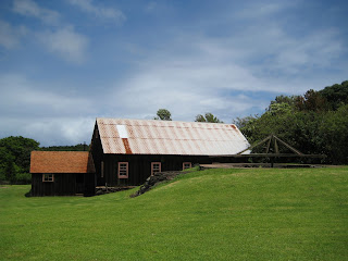
The image shows the hale pili of Keʻelikōlani (Princess Ruth) on the grounds of Huliheʻe Palace in Kona (the style of house she preferred over the modern version nearby;) this is where she died on May 24, 1883.  In addition, I have added other related images in a folder of like name in the Photos section on my Facebook and Google+ pages.

Follow Peter T Young on Facebook  

Follow Peter T Young on Google+  

© 2013 Hoʻokuleana LLC

Sunday, July 28, 2013

Ahupuaʻa ‘Anomalies’


Typically, we think of ahupuaʻa in the general context of the modern day watershed – from the mountains to the sea (ridges to reefs,) affording occupants access to the various climatic and resource zones.

Ahupuaʻa served as a means of managing people and taking care of the people who support them, as well as an easy form of collection of tributes by the chiefs.  Ultimately, this helped in preserving resources.

Shaped by island geography, ahupuaʻa varied in shape and size (from as little as 100-acres to more than 100,000-acres.)

Each ahupuaʻa had its own name and boundary lines.  Often the markers were natural features such as a large rock or a line of trees or even the home of a certain bird.  A valley ahupuaʻa usually used its ridges and peaks as boundaries.

In ancient Hawaiian times, relatives and friends exchanged products.  The upland dwellers brought poi, taro and other foods to the shore to give to kinsmen there.  The shore dweller gave fish and other seafood.  Visits were never made empty-handed but always with something from one's home to give.

Ahupuaʻa contained nearly all the resources Hawaiians required for survival.  Fresh water resources were managed carefully for drinking, bathing and irrigation.

A typical ahupuaʻa was a long strip of land, narrow at its mountain summit, becoming wider as it ran down a valley into the sea to the outer edge of the reef.  If there was no reef, then the sea boundary would be one-mile from the shore.

However, there are several ‘anomalies’ to this conventional ahupuaʻa layout.

Some include multiple parts, even skipping over water.  Others do not have contact with the ocean, nor reach a mountain peak.  Another includes portions of a couple of mountains.  Here are some examples (there are others, as well.)

On the island of Hawaiʻi, the ahupuaʻa of Kīʻao in the moku (district) of Kāʻu is land-locked and doesn’t reach the ocean.  (Paman)  In addition, it doesn’t reach a mountain summit.

Also on the Island of Hawaiʻi, the ahupuaʻa of Humuʻula starts at the summit of Mauna Loa, crosses the saddle between the two mountains and skirts along the side of Mauna Kea and eventually runs down to the ocean along the Hāmākua coast.

This traversing along a relatively similar contour on the side of Mauna Kea is unique; in addition, in doing so, it essentially cuts off the numerous ahupuaʻa along the South Hilo, North Hilo and Hāmākua coasts to the Mauna Kea summit.

Interestingly, the entire island of Kahoʻolawe is part of the Honuaʻula moku (district) across the ocean on Maui.  Kahoʻolawe is not its own ahupuaʻa; rather, it is divided into ʻili (smaller land units within ahupua‘a.)

Historically, a “cloud bridge” connected Kahoʻolawe with the slopes of Haleakalā.  The Naulu winds brought the Naulu rains that are associated with Kahoʻolawe (a heavy mist and shower of fine rain that would cover the island.)

Heʻeia on the windward side of Oʻahu runs from the mountains to the sea, but also crosses over a portion of the water in Kāneʻohe Bay and includes a portion of a Mōkapu peninsula across the Bay.

The Waiʻanae ahupuaʻa also has an un-typical shape – it is sometimes referred to in two parts: Waiʻanae Kai, on its western side, runs from the ocean to the Waiʻanae Mountains (like a typical ahupuaʻa – this portion of Waiʻanae runs from the mountain to the sea.)

From there, however, the section referred to as Waiʻanae Uka continues across Oʻahu’s central plain and extends up into the Koʻolau Mountains – extending approximately 15-miles from the Waianae Mountains to the Koʻolau Mountains and ends up overlooking the windward coastline.  (Each section is within the same ahupuaʻa.)

Waimānalo is another Oʻahu ahupuaʻa that is ‘anomalous’ to the ‘ridges to reefs’ characterization of the ‘typical’ ahupuaʻa.

Waimānalo extends from the ridge behind Keolu Hills, around Makapuʻu and ending at Kuliʻouʻou Ridge (Koʻolaupoko Hawaiian Civic Club;) it essentially wraps over the Koʻolau range from the windward coast to the leeward coast Oʻahu.

Waimānalo incorporates what was once the large fishpond of Maunalua, now known as Hawaiʻi Kai. Kamakau notes, “The ahupuaʻa of Waimānalo, including the fishpond at Maunalua and the travelling uhu of Makapuʻu, belonged to Mauimua (First-Maui.)”  (Koʻolaupoko Hawaiian Civic Club)

The image shows a map of the Islands with some of the anomalies to the typical’ ahupuaʻa.  In addition, I have included other related images in a folder of like name in the Photos section on my Facebook and Google+ pages.

Follow Peter T Young on Facebook  

Follow Peter T Young on Google+  

© 2013 Hoʻokuleana LLC

Saturday, July 27, 2013

Kalaniʻōpuʻū


At the time of Captain Cook’s arrival (1778-1779), the Hawaiian Islands were divided into four kingdoms: (1) the island of Hawaiʻi under the rule of Kalaniʻōpuʻu, who also had possession of the Hāna district of east Maui; (2) Maui (except the Hāna district,) Molokaʻi, Lānaʻi and Kahoʻolawe, ruled by Kahekili; (3) Oʻahu, under the rule of Kahahana; and (4) Kauaʻi and Niʻihau, Kamakahelei was ruler.

Kalaniʻōpuʻu was born about 1729, the son of Kalaninuiamamao and his wife Kamakaimoku. He died at Waioahukini, Kaʻū, in April 1782.  His brother was Keōua; his son was Kiwalaʻō; he was the grandfather of Keōpūolani.

When Keōua, the father of Kamehameha, died, he commended his son to the care of Kalaniʻōpuʻu, who received him, and treated him as his own child. (Dibble)

Kiwalaʻo, a real son of Kalaniʻōpuʻu, occasioned much trouble to his father, and in several instances proceeded so far as to engage in open revolt. Kamehameha seems always to have been obedient and to have possessed the good will of Kalaniʻōpuʻu.  (Dibble)

At the death of Alapaʻinui, about 1754, a bloody civil war followed, the result of which was that Alapaʻi’s son Keaweopala was killed, and Kalaniʻōpuʻu, descended from the old dynasty, became king of Hawaiʻi.  (Alexander)

Kalaniʻōpuʻu, from the very beginning of his reign, made repeated attempts to conquer the neighboring island of Maui.  He held portions of the Hāna district and the Kaʻuiki fort in 1775, when, in the war between Hawaiʻi and Maui, he commanded a raid in the Kaupō district.  (Thrum)

While Kalaniʻōpuʻu was at Hāna he sent his warriors to plunder the Kaupō people. Kahekili was king of Maui at that time, when Kahekili’s warriors met those of Kalaniʻōpuʻu at Kaupō, a battle developed between the two sides.  It was known as the Battle of Kalaeokaʻīlio; Kalaniʻōpuʻu’s army was routed and returned to Hāna.

Kalaniʻōpuʻu promised revenge and, in 1776, he again went to battle against Kahekili. This battle (known as the Battle of Sand Hills or Ahalau Ka Piʻipiʻi O Kakaniluʻa) was recorded as one of the most bloody.

Unfortunately, Kalaniʻōpuʻu was not aware of the alliance between Kahekili and the O‘ahu warriors under Kahahana, the young O‘ahu chief, and these numerous warriors were stationed at the sand dunes of Waikapū and also at a place close to those sand dunes seaward of Wailuku.

Kalaniʻōpuʻu’s army was annihilated as they entered the sand hills of Wailuku. In a desperate act to save what was left, Kalaniʻōpuʻu requested that his wife, Kalola, plead for peace from her brother Kahekili.

However, knowing that Kahekili would not look upon her with favor, Kalola suggested their son, Kiwalaʻo be sent instead. Kahekili welcomed Kiwala‘ō; for a time, after the great Sand Hills battle in Wailuku, peace and tranquility returned.

Although often defeated, Kalaniʻōpuʻu managed to hold the famous fort of Kaʻuiki in Hāna for more than twenty years.  (Alexander)

At the time of Captain Cook’s arrival (1778-1779), Kalaniʻōpuʻu was on the island of Maui.  Kalaniʻōpuʻu returned to Hawaiʻi and met with Cook on January 26, 1779, exchanging gifts, including an ʻahuʻula (feathered cloak) and mahiole (ceremonial feather helmet.)   Cook also received pieces of kapa, feathers, hogs and vegetables.

In return, Cook gave Kalaniʻōpuʻu a linen shirt and a sword; later on, Cook gave other presents to Kalaniʻōpuʻu, among which one of the journals mentions "a complete Tool Chest."

After the departure of the Resolution and Discovery, Kalaniʻōpuʻu left the bay and passed to Kaʻū, the southern district of Hawaiʻi, having in his charge the young Kaʻahumanu. (Bingham)

In about 1781, Kahekili was able, by a well-planned campaign, to regain possession of the Hāna district and this marked the beginning of the disintegration of Kalaniʻōpuʻu’s kingdom.  (Kuykendall)

Kalaniʻōpuʻu died shortly thereafter (1782.) Before his death, Kalaniʻōpuʻu gave an injunction to Kiwalaʻo and Kamehameha, and to all the chiefs, thus: “Boys, listen, both of you. The heir to the kingdom of Hawaii nei, comprising the three divisions of land, Kaʻū, Kona and Kohala, shall be the chief Kiwalaʻo. He is the heir to the lands.” (Fornander)

“As regarding you, Kamehameha, there is no land or property for you; but your land and your endowment shall be the god Kaili (Kūkaʻilimoku.) If, during life, your lord should molest you, take possession of the kingdom; but if the molestation be on your part, you will be deprived of the god.” These words of Kalaniʻōpuʻu were fulfilled in the days of their youth, and his injunction was realized.  (Fornander)

Following Kalaniʻōpuʻu’s death in 1782, and following his wishes, the kingship was inherited by his son Kīwalaʻō; Kamehameha (Kīwalaʻō's cousin) was given guardianship of the Hawaiian god of war, Kūkaʻilimoku.)

Kiwalaʻō and his chiefs were dissatisfied with subsequent redistricting of the lands; civil war ensued between Kīwalaʻō's forces and the various chiefs under the leadership of Kamehameha (his cousin.)

In the first major skirmish, in the battle of Mokuʻōhai (a fight between Kamehameha and Kiwalaʻo in July, 1782 at Keʻei, south of Kealakekua Bay on the Island of Hawaiʻi,) Kiwalaʻo was killed.

With the death of Kiwalaʻo, the victory made Kamehameha chief of the districts of Kona, Kohala and Hāmākua, while Keōua, the brother of Kiwalaʻo, controlled Kaʻū and Puna, and Keawemauhili declared himself independent of both in Hilo.  (Kalākaua)

Kamehameha, through the assistance of the Kona "Uncles" (Keʻeaumoku, Keaweaheulu, Kameʻeiamoku & Kamanawa (the latter two ended up on the Island’s coat of arms;)) succeeded, after a struggle of more than ten years, in securing to himself the supreme authority over that island (and later, the entire Hawaiian Islands chain.)

The image shows Kalaniʻōpuʻu welcoming Cook at Kealakekua, as depicted by Herb Kane.    In addition, I have included other images in a folder of like name in the Photos section on my Facebook and Google+ pages.

Follow Peter T Young on Facebook  

Follow Peter T Young on Google+  

© 2013 Hoʻokuleana LLC

Friday, July 26, 2013

Schofield Barracks


In 1872, Major General John M Schofield visited the Hawaiian Islands to determine the defense capabilities of the various ports. In his report to the Secretary of War, Schofield advocated securing the exclusive use of Pearl Harbor through a reciprocity treaty with the then Kingdom of Hawaiʻi.

In 1893, after the overthrow of the monarchy, it was Schofield who encouraged annexation of Hawaiʻi. He said, “if we do not hold these islands ourselves we cannot expect the neutrals in war to prevent other belligerents from occupying them; nor can the inhabitants themselves prevent such occupation.”

The site that would become Schofield Barracks was ceded to the US Government on July 26, 1899, less than a year after Hawaiʻi was annexed to the United States. The Waianae-Uka military reservation was part of the former Hawaiian Crown Lands and consisted of 14,400 acres.  (Army)

In 1905, in an address to Congress, President Theodore Roosevelt declared Hawaiʻi to be, “the most important point in the Pacific to fortify in order to conserve the interests of this country.”  (LOC)

Situated between the two major mountain ranges on Oʻahu, with central access to both the North Shore, Pearl Harbor and the City of Honolulu made it an excellent strategic location.

Schofield Barracks was established on December 4, 1908, with the arrival of Captain Joseph C Castner and his construction of a temporary cantonment (headquarters and quarters) on the Waianae-Uka military reservation – first, tents for officers and soldiers; then, temporary wooden barracks.

The temporary facility was informally referred to as Castner Village; some called it the Leilehua Barracks (after the Leilehua Plain on which it is located.)  In April, 1909, the War Department chose to name the post after the late General John M Schofield, former Commanding General of the US Army, who had originally called attention to Hawaiʻi’s strategic value.

In 1910, the United States Army District of Hawaiʻi was formed under the command of Colonel Walter Schuyler at Schofield Barracks. It originally fell under the jurisdiction of the Department of California and then became a department in the newly organized Western Division.

In late-1911, the Secretary of War approved recommendations for a seven-regiment post. This would rival the Army’s largest existing post at the time (Fort Russell in Cheyenne, Wyoming.)  The number of troops continued to increase, and in 1913 the Hawaiian Department was formed as an independent command under the War Department.

Permanent facilities were urgently needed.

The configuration of three barracks and one administration building surrounding a central courtyard became known as a “quad” (quadrangle.)  The quads at first took their names from the troops residing in them, i.e. the 35th Infantry Barracks or the 4th Cavalry Barracks. The alphabetical designations currently used were assigned at a later date.  Quarters for the officers and their families were constructed at the same time as the barracks.

In 1921, Schofield housed the only complete division in the US Army (the Hawaiian Division) and the Army’s largest single garrison. Population rose to 14,000 in 1938, making it the second largest “city” in Hawaiʻi. The Hawaiian Department accounted for more than 10% of the Army’s forces during the ‘30s and ‘40s.  (By 1948, the base had eight sets of quad barracks.)

On October 1, 1941, the transition by the War Department in operations restructured the Hawaiian Division to form two divisions at Schofield: 24th Infantry Division and the 25th Infantry Division.  (Over the following decades, the 24th ID was inactivated, reactivated and subsequently deactivated in October 2006.  Schofield remains the home of the 25th ID.)

The need for soldiers trained to fight under tropical conditions arose and the Jungle Training Center, later called the Ranger Combat Training School was formed in late-1942. The Hawaiʻi Infantry Training Center (HITC) was opened on March 14, 1951. Almost one-million soldiers went through the training center at Schofield before being sent overseas.

With the construction of housing on the old training fields and in light of the greater range and fire power of the new weaponry, larger training areas were needed. Pōhakuloa on the island of Hawaii, Makua Valley, Helemano, Kahuku and Kawailoa were used.  Most of these training areas are still actively used by the 25th Infantry Division today.

Today, the Schofield Barracks Area includes Wheeler Army Airfield and Helemano Military Reservation and consists of 16,600-acres. Two brigades of the 25th Infantry Division and other units that support them are housed there.

There are approximately 14,000 military personnel as well as 2,000-civilian employees who work and train at Schofield. 21,100-soldiers and their dependents live on the premises.

The image shows housing at Schofield Barracks in 1925.  (Lots of information here is from NPS and Army-mil.)   In addition, I have added other images in a folder of like name in the Photos section on my Facebook and Google+ pages.

Follow Peter T Young on Facebook  

Follow Peter T Young on Google+  

© 2013 Hoʻokuleana LLC

Thursday, July 25, 2013

Mākaha


The ahupuaʻa of Mākaha, between Waiʻanae Ahupuaʻa to the southeast and Keaʻau Ahupua‘a to the northwest, extends from the coastline to the Waiʻanae Range.

Pukui noted Mākaha means “fierce;” Roger C. Green suggests it relates to “fierce or savage people” once inhabiting the valley.

Green refers to “…the ʻŌlohe people, skilled wrestlers and bone-breakers, by various accounts [who] lived in Mākaha, Mākua, and Keaʻau, where they often engaged in robbery of passing travelers.”  (Cultural Surveys)

Earliest accounts describe Mākaha as a good-sized inland settlement and a smaller coastal settlement.  These accounts correlate well with a sketch drawn by Bingham in 1826 depicting only six houses along the Mākaha coastline.

Green describes Mākaha’s coastal settlement as “…restricted to a hamlet in a small grove of coconut trees on the Keaʻau side of the valley, some other scattered houses, a few coconut trees along the beach, and a brackish water pool that served as a fish pond, at the mouth of the Mākaha Stream.” (Cultural Surveys)

This stream supported traditional wetland agriculture – kalo (taro) - in pre-contact and early historic periods

Supporting this, Māhele documents note Mākaha’s primary settlement was inland where waters from Mākaha Stream could support lo‘i and kula plantings. Although there is evidence for settlement along the shore, for the most part, this was limited to scattered, isolated residents.

A “cluster” of habitation structures was concentrated near Mākaha Beach, near the Keaʻau side of Mākaha where there is also reference to a fishpond.

John Papa ʻĪʻī described a network of Leeward O‘ahu trails, which in early historic times crossed the Waiʻanae Range, allowing passage from Central O‘ahu through Pōhākea Pass and Kolekole Pass.

The old coastal trail probably followed the natural contours of the topography. With the introduction of horses, cattle and wagons in the 19th century, many of the coastal trails were widened and graded to accommodate these new introductions.  The Pu‘u Kapolei trail gave access to the Waiʻanae district from Central O‘ahu, which evolved into the present day Farrington Highway.

Kuhoʻoheihei (Abner) Pākī, father of Bernice Pauahi, was given the entire ahupuaʻa of Mākaha by Liliha after her husband, Boki, disappeared in 1829.

In 1855, after Chief Pākī died, the administrators of his estate sold the Mākaha lands to James Robinson and Co. Later, in 1862, one of the partners, Owen Jones Holt, bought out the shares of the others.

The Holt family dominated the social, economic and land-use activities in Mākaha until the end of the 19th century. During the height of the Holt family presence, from about 1887 to 1899, the Holt Ranch raised horses, cattle, pigs, goats and peacocks.

Mākaha Coffee Company bought land for coffee cultivation in the Valley, although coffee never caught on. On Holt’s death in 1862, the lands went into trust for his children.

By 1895 the OR&L rail line reached Waiʻanae.  It then rounded Kaʻena Point to Mokuleʻia, eventually extending to Kahuku.  Another line was constructed through central O‘ahu to Wahiawa.

The Holt Ranch began selling off its land in the early-1900s.

In 1908, the Waiʻanae Sugar Company moved into Mākaha and by 1923, virtually all of lower Mākaha Valley was under sugar cane cultivation.  The plantation utilized large tracks of Lualualei, Waiʻanae and Mākaha Valley.

In the 1930s, Waiʻanae Plantation sold out to American Factors Ltd (Amfac.)  They started looking for a water source to increase production of the thirsty crop.  They tunneled for water; Glover Tunnel, named for the contractor, was 4,200-feet long and had a daily water capacity of 700,000-gallons. The water made available was mainly used for the irrigation of sugar.

For a half century, Mākaha was predominantly sugarcane fields.  However, by the middle of the century, the operations were no longer profitable and the plantation started to liquidate.

In 1946, the Dillinghams announced that they were discontinuing rail service, citing decline in tonnage, rising labor costs and tsunami damage in the system. On October 17, 1946 the stockholders of American Factors (owners of the Waiʻanae Sugar Company) voted to liquidate.

Chinn Ho’s Capital Investment Corporation bought the Mākaha lands and looked to resort development in the Valley.  He envisioned a travel destination that would be the next Kaʻānapali or even Waikiki, with golf courses, condominiums and hotels.

When the Mākaha big surf break was discovered and the eventual Mākaha International Surfing Championship was underway, tourists starting coming to Waiʻanae in the 1950s, as pioneer surfers made Mākaha Beach famous.

In 1969, the Mākaha Resort was built, including Mākaha Inn and Country Club, with an 18-hole course with tennis courts, restaurant and other golf facilities was opened for local and tourist use.

Over the decades, the resort has had several starts and stops, as well as a number of transfers of ownership.  Recent reports note the hotel is in foreclosure and closed, however, golf is open for play on the Valley’s two courses.

The image shows a portion of Mākaha Valley.  In addition, I have added other images and maps in a folder of like name in the Photos section on my Facebook and Google+ pages.

Follow Peter T Young on Facebook  

Follow Peter T Young on Google+  

© 2013 Hoʻokuleana LLC

Wednesday, July 24, 2013

Ala Moana Beach Park and ʻĀina Moana (Magic Island)


In 1899, the coastal road from Honolulu Harbor to Waikīkī, formerly called the “Beach Road,” was renamed “Ala Moana.”

At the beginning of the twentieth-century, this stretch of coast makai of Ala Moana Boulevard was the site of the Honolulu garbage dump, which burned almost continually.  The residue from burned rubbish was used to reclaim neighboring wetlands (which later were more commonly referred to as “swamp lands.”)

In the 1920s, Kewalo Basin was constructed and by the 1930s was the main berthing area for the sampan fleet and also the site of the tuna cannery, fish auction, shipyard, ice plant, fuel dock and other shore-side facilities.

In 1928, a channel was dredged through the coral reef to connect the Ala Wai Boat Harbor and the Kewalo Basin, so boats could travel between the two.  Part of the dredge material helped to reclaim swampland that was filled in with dredged coral.

When the area became a very popular swimming beach, the channel was closed to boat traffic.

The City and County of Honolulu started cleaning up the Ala Moana area in 1931. They used funds provided by President Franklin Delano Roosevelt's New Deal Project to create a city park in the Ala Moana area.

Back in the early twentieth century, most playgrounds consisted of large areas of pavement used to get children off of the street and had no aesthetic value.

In 1933, Harry Sims Bent was chosen as the park architect for the City and County of Honolulu.  Bent’s design went beyond the modern level and into the realm of art deco, allowing for play, as well as contact with nature.  His works at Ala Moana include the canal bridge, entrance portals, sports pavilion, banyan courtyard and the lawn bowling green.

President Roosevelt participated in the dedication of the new 76-acre "Moana Park" in 1934 (it was later renamed Ala Moana Park in 1947.)  During his visit to the islands, Roosevelt also planted a kukui tree on the grounds of the ʻIolani Palace.

Ala Moana Park was developed on a swamp and the Honolulu garbage dump.

In the mid-1950s, reef rubble was dredged to fill in the old navigation channel (between Kewalo and the Ala Wai); it was topped with sand brought from Keawaʻula Beach (Yokohama Beach) in Waianae.

At the same time, a new swimming channel was dredged parallel to the new beach, extending 400-feet offshore; in addition, the west end of the fronting channel was closed by a landfill project that was part of the Kewalo Basin State Park project.  A large fringing reef remained off-shore protecting the beach area.

Reportedly, in 1955, Henry Kaiser was the first to propose building two artificial islands and six hotels over the fringing reef.  His proposal included inlets for boats, walkways and bridges. He called it Magic Island and offered to pay the $50-million cost.  (Sigall, Star-Advertiser)

In 1958, a 20-page booklet was sent to Congress to encourage them to turn back Ala Moana Reef to the Territory of Hawaiʻi for the construction of a "Magic Island."  Local businessmen and firms paid half the cost and the Territory paid half through the Economic Planning & Coordination Authority)   (Dillingham interests were among contributors, Henry J. Kaiser interests were not.)   (Honolulu Record, February 13, 1958)

The booklet puts forth the argument that "Tourist development is our most important immediate potential for economic expansion," and displays pictures of the crowded Waikiki area to show the lack of room for expansion.  Then it directs the reader's attention to land that can be reclaimed from the sea by utilizing reefs, especially the 300-acre area of Ala Moana Reef.  (Honolulu Record, February 13, 1958)

It was supposed to be part of a new high scale beachfront resort complex with a half-dozen hotels that would have included two islands built on the fringing reef, offshore of the Ala Moana Park.

The Interest of the Dillingham’s in developing off-shore areas is obvious, since Hawaiian Dredging is the only local company large enough to undertake such sizable dredging operations. The Dillingham interest in the current "Magic Island" project is more obvious because of the immediate increase in value it would bring to Dillingham land mauka of Ala Moana Boulevard.  (Honolulu Record, February 13, 1958)

The Dillinghams figure to do the dredging and construction of Magic Island, itself, of course, and it must be recalled that the original Dillingham idea was to use Ala Moana Park for hotels and apartments and build the reef island for a park.  (Honolulu Record, May 15, 1958)

But now that Magic Island is being proposed as a hotel and apartment site, it doesn't mean for a moment the first plan has necessarily been abandoned. There is good reason to fear Ala Moana Park may be wiped out entirely so far as the people of Oahu are concerned if they don't keep alert and guard" against every effort to encroach upon it.  (Honolulu Record, May 15, 1958)

Substantial changes were made from the more extensive original plan for the Ala Moana reef; rather than multiple islands for several resort hotels built on the reef flat off of the Ala Moana Park, in 1964 a 30-acre peninsula, with “inner” and “outer” beaches for protected swimming, was constructed adjoining the Ala Wai Small Boat Harbor and Ala Wai Canal outlet.

The project stopped after the development of “Magic Island,” leaving the State with a man-made peninsula, which they converted into a public park.

In 1972 the State officially renamed Magic Island to ‘Āina Moana (“land [from the] sea”) to recognize that the park is made from dredged coral fill. The peninsula was turned over the city in a land exchange and is formally known as the ‘Āina Moana Section of Ala Moana Beach Park, but many local residents still call it Magic Island.

Between 1955 and 1976 the beach eroded, and in 1976, more sand was brought in from Mokuleʻia on the north coast of Oʻahu.

The image shows one of the Ala Moana Beach Parks bridges.  In addition, I have added other images in a folder of like name in the Photos section on my Facebook and Google+ pages.

Follow Peter T Young on Facebook  

Follow Peter T Young on Google+  

© 2013 Hoʻokuleana LLC

Tuesday, July 23, 2013

Hui Kawaihau


When Kalākaua ascended to the throne in 1874, he named his youngest brother, William P Leleiōhoku, the heir apparent.

Leleiōhoku was educated at Saint Alban's College (forerunner to ʻIolani School.)  An accomplished musician, he founded several choral societies. One of them was called Hui Kawaihau.

The Hui Kawaihau name was based on a nickname for an American missionary woman in town who preferred iced water ('Kawaihau') over some of the alcoholic libations the others were enjoying.

Leleiōhoku composed several songs, including, Adios Ke Aloha, Aloha No Wau I Ko Maka, Nani Wali Līhuʻe, Moani Ke Ala, Ke Kaʻupu, He Inoa No Kaʻiulani (a different song from the one with the same name by Liliʻuokalani), Nani Waipiʻo, Hole Waimea (this one was co-written with his singing club.)

He also wrote Kaua I Ka Huahuaʻi (Johnny Noble adapted most of the melody and kept most of the same lyrics of this one, and changed the spelling of the title, for his 1926 song Hawaiian War Chant (Taua I Ta Huahuaʻi.))

The Hui Kawaihau choral group had about fifteen members; it was more social than business.  When Leleiōhoku died in 1877, King Kalākaua reorganized the Hui into a business group.

Among the twelve hui charter organizers were some well-known names, including King Kalākaua; Governor Dominis, the King's brother-in-law; Colonel George W. Macfarlane; Captain James Makee; Col. Curtis P. ʻIaukea; Governor John M. Kapena of the Island of Oahu; J. S. Walker and C. H. Judd; and Koakanu, a high chief of Kōloa, on Kauaʻi.

Their first order of business was to sign on more members and contract for the cultivation of sugar cane on land in Kapaʻa, on Kauaʻi.

The twelve organizers signed up thirty-two resident members.  About the first of August, 1877, the members of the Hui - over twenty men, with about the same number of women and children - set out from Honolulu, on the steamer "Kilauea," on the voyage to their new home on Kauaʻi.

At the time, the districts of Hanalei and Līhuʻe shared a common boundary.  Kawaihau was set apart by the King, who gave that name to the property lying between the Wailua River and Moloaʻa Valley.  A bill was introduced into the legislature and the eastern end of Hanalei District was cut out and Kawaihau became the fifth district on the island of Kauaʻi.

About the time the Hui was started, Captain James Makee obtained a concession from the King to build a sugar mill at Kapaʻa and establish a plantation there.  He was the first manager of the Plantation, and had agreed with Kalākaua to grind in his mill all the cane grown by the Hui.

The contract with the Makee Sugar Company (under which each members of the Hui who came to Kauaʻi had signed separately with the plantation) required each of them to plant two hundred and forty acres of cane the first year, and they were to receive, in payment for their cane, two-fifths of the returns from the sale of the sugar obtained from it.

Each planter was required to plow his own portion of the tract and to buy his own seed-cane for planting.  A portion of the seed cane came from the neighboring Līhuʻe Plantation, ten miles to the south, and the balance they brought from Lāhainā.

Upon Makee's death in 1878, his son-in-law, Col. ZS Spalding took over management of the new sugar venture.  Spalding also started the neighboring Keālia Sugar Plantation.  In the 1880s, Spalding built the "Valley House," a Victorian-style wooden mansion, one of the finest on the island.

From 1877 to 1881, Hui Kawaihau was one of the leading entities on the eastern side of the Island of Kauaʻi, growing sugar at Kapahi, on the plateau lands above Kapaʻa.

As part of the infrastructure of the new plantation, the Makee Landing was built in Kapaʻa during the early years of the Makee Sugar Plantation.   Today, in place of the old Makee Landing, a breakwater is located on the north side of Mōʻīkeha Canal.

The Hui members all worked their share of the plantation - cultivating, irrigating and weeding the sugar cane under their supervision.  But they were all new to the business of growing cane - being mostly city men from Honolulu - all clerks and office men, etc.

The first crop was quite successful, netting the Hui over $17,000, from which was deducted the expense paid by the King for the Hui's transportation to Kauaʻi, and the preliminary operations there - about $5000, which left enough to pay the members nearly $500 apiece, after paying the expenses.

In spite of the successful opening of the enterprise, it soon encountered dark days.  For nearly four years, troubles were increasing.

Colonel Spalding advised them to sell out to the Plantation, and thus end all their troubles; but they would not agree.

By 1881, four years after the favorable opening of the Hui's plantation efforts, the members, disheartened and discouraged, had all drifted away, their property and leasehold rights, etc., passing into the hands of Colonel Spalding, the successor of Captain Makee as the head and principal owner of the Makee Sugar Company.

The Hui Kawaihau of Kauaʻi had passed into history.

In 1933, the Līhuʻe Plantation Co. purchased all of the outstanding Makee Sugar Co. stock and in the next year the mill was dismantled and combined with the Līhuʻe factory.

(Lots of information here from "The Hui Kawaihau" by Charles S Dole and The Friend, April, 1920.)  The image shows the Kawaihau District on the Island of Kauaʻi. In addition, I have added other images in a folder of like name in the Photos section on my Facebook and Google+ pages.

Follow Peter T Young on Facebook  

Follow Peter T Young on Google+  

© 2013 Hoʻokuleana LLC

Monday, July 22, 2013

Meyer Sugar


At the age of twenty-four, Rudolph Wilhelm Meyer emigrated from Germany to Hawaiʻi where he arrived on January 20, 1850.  At the time, Meyer listed his occupation as a surveyor.

His main purpose in leaving Germany was to join the “Gold Rush” to California in 1848, but he was delayed on a stopover in Sidney, Australia, and again in Tahiti, after which he landed at Lāhaina, Maui.

Meyer spoke German, French and English when he arrived in Hawaiʻi, and soon wrote and spoke fluent Hawaiian.

Meyer settled on Molokaʻi.  There, he met the Reverend Harvey Rexford Hitchcock I, who accepted him as a house guest at Kaluaʻaha, Molokaʻi.

While living with Reverend Hitchcock, he met High Chiefess Kalama Waha, who later became his wife.  Sometime later, he moved his family to Honolulu where he worked for Austin and Becker at an office located on Maunakea Street.

The Meyer family later moved back to Molokaʻi and made their permanent residence at Kalaʻe.  They eventually had eleven children, six boys and five girls.

He supported his family, in part, by holding a number of local commissions from the Royal Hawaiian government, but primarily from his diverse agricultural activity.

Ranching began on Moloka‘i in the first half of the 19th-century when Kamehameha V set up a country estate on the island, part of which is now the Moloka‘i Ranch. Rudolph Meyer, one of the first western farmers on Moloka‘i, served as ranch manager for King Kamehameha V.  (DLNR)

He planted at various times coffee,  corn,  wheat,  oats,  taro,  potatoes,  beets,  cassava,  peaches, mangoes,  bananas  and grapes. He was the first on Molokaʻi to grow, produce and mill sugar and coffee commercially and he exported these to Honolulu and California. He also operated a large dairy from which he produced butter.

Meyer started to grow sugar at the time when the 1876 Reciprocity Treaty between the United States and Hawaiʻi removed the tariff on Hawaiian sugar sold in the United States.

Rather than the expansion and innovation that followed the Treaty, Meyer scaled his mill to satisfy the modest 50- ton annual production from his family's 30-acres of sugar cane.

Constructed in the 1870s the RW Meyer Sugar Mill is one of the only sites in Hawaiʻi with sufficient material remains intact to demonstrate, fairly completely, a nineteenth-century process of sugar manufacture.  The equipment included a mule-driven cane crusher, redwood evaporating pans and some copper clarifiers.

In the early-1880s, when the average investment in Hawaiʻi’s fifth-six sugar plantations exceeded $280,000, the Meyer family investment of $10,000 made their mill one of the smallest in Hawaiʻi.

Meyer adopted and followed mill practices more representative of the 1850s and the 1860s than the 1870s and 1880s.  In the 1850s, animals powered the mill equipment; while he stuck with this method into the future, others replaced the animal power with steam and water.

The Meyer Sugar Mill easily accommodated the milling requirements of the family's sugar lands and repaid the investment within a few years; however, during the 1880s the price paid for sugar steadily declined.

The Planters' Monthly reported in July, 1887, that  "Low prices of  sugar still prevail...and many a  man who once thought himself assured of  reasonable wealth through sugar,  now finds that it will not even yield him a  competence...only running the sugar business on a  large  scale can  it be made to  pay."

In 1892, CM Hyde reported that the Meyer Mill stopped producing sugar cane when  "The  low price of the  product for  the  last  few years ... made  it more than unprofitable to  engage  in  sugar manufactured in a  small way. Now the lands are given up to grazing."

Meyer also served as the Superintendent of the isolated Kalawao settlement (Kalaupapa) (serving with Father Damien and Mother Marianne Cope (now, both are Saints)) from 1866 till his death in 1897 (he continued to live with his family at the top of the cliffs, rather than on the Kalaupapa Peninsula.)

He also created one of the first trails used to travel between Kalaupapa Peninsula and the mauka lands.  It was used to transport cattle and supplies down to Kalawao.

RW Meyer Ltd still owns property in the southwest corner of the Kalaupapa National Historical Park near the Kalaupapa Trailhead and maintains a Memorandum of Understanding (MOU) with the Park for trail access, maintenance and the planting of native plants.

The Meyer Mill has been restored and is operating as a museum.  Lots of information here is from NPS and rwmeyer-com.  The image shows the RW Meyer Sugar Mill.  In addition, I have added other images in a folder of like name in the Photos section on my Facebook and Google+ pages.

Follow Peter T Young on Facebook  

Follow Peter T Young on Google+  

© 2013 Hoʻokuleana LLC

Sunday, July 21, 2013

Before The Stone Church


By the time the first company of American Board of Commissioners for Foreign Missions (ABCFM) Protestant missionaries arrived in 1820, Kamehameha I had died and the centuries-old kapu system had been abolished.  Through the actions of King Kamehameha II (Liholiho,) with encouragement by former Queens Kaʻahumanu and Keōpūolani (Liholiho’s mother,) the Hawaiian people had already dismantled their heiau and had rejected their religious beliefs.

The missionaries first lived in the traditional Hawaiian house, the hale pili.  These were constructed of native woods lashed together with cordage most often made from olonā. Pili grass was a preferred thatching that added a pleasant odor to a new hale. Lauhala (pandanus leaves) or ti leaf bundles called peʻa, were other covering materials used.

In addition to their homes, the missionaries had grass meeting places, and later, churches.  One of the first was on the same site as the present Kawaiahaʻo Church.

On April 28, 1820, the Protestant missionaries held a church service for chiefs, the general population, ship's officers and sailors in the larger room in Reverend Hiram Bingham's house.  This room was used as a school room during the weekdays and on Sunday the room was Honolulu's first church auditorium.  (Damon)

It was the fore-runner to what we know today as Kawaiahaʻo Church (and the first foreign church on Oʻahu.)  There were several other earlier buildings that served as a Honolulu church/meeting house, until the present “Stone Church” (Kawaiahaʻo) was completed in 1842.

On December 31, 1820, Levi Sartwell Loomis, son of Elisha and Maria Loomis (the first white child born in the Sandwich Islands) and Sophia Moseley Bingham, daughter of Hiram and Sybil Bingham (the first white girl born on Oʻahu) were baptized.

In July, 1821, the missionaries had raised enough money and started to plan a church; the site was just makai of the existing Kawaiahaʻo Church.  A month later, they began to build a 22 by 54 foot building, large enough to seat 300.

This first church building was built of thatch and lined with mats; however, it had glass windows, doors, a wooden pulpit and 2-rows of seats, separated by an aisle.  In August of that year, Captain Templeton presented a bell from his ship to be used at the church.

Within a year, Hiram Bingham began to preach in the Hawaiian language.  4-services a week were conducted (3 in Hawaiian and 1 in English.)    Congregations ranged from 100 – 400; by the end of the year, the church was expanded.

The church conducted its first funeral in January 1823 for Levi Parson Bingham, infant (16-days) son on Hiram and Sybil Bingham.  Three days later, a Hawaiian chief requested similar services on the death of a royal child.  (Damon)

On May 30, 1824, the church burned to the ground.  “Sabbath evening, May 30, nine o’clock. About an hour since, we were alarmed by the ringing of the chapel bell, and, on reaching the door, discovered the south end of the building in one entire blaze. ... In five minutes the whole was on fire.”  (Stewart – Damon)

Within a couple of days after the fire, Kalanimōkū ordered a new church to be built at public expense. A new thatched building (25 by 70 feet) was placed a short distance from the old; it was dedicated July 18, 1824.

1825 saw another sad funeral when the bodies of Liholiho (King Kamehameha II) and his wife Queen Kamāmalu were brought home from England.  The church was draped in black.

Interest in the mission’s message outgrew the church and services were held outside with 3,000 in attendance; efforts were underway to build a larger facility to accommodate 4,000.

Kalanimōkū marked out the ground for the new meeting house “on the North side of the road, directly opposite the present house, whither they have commenced bringing coral rock formed on the shore and cut up in pieces of convenient size.”  (Chamberlain – Damon)  Timber frame and thatching completed the building.

In December, 1825, the third Meeting House building was opened for worship; however, shortly afterward a violent rain storm collapsed the structure.

In 1827 (after Kalanimōkū’s death,) Kaʻahumanu stepped forward and “caused a temporary house to be erected which is 86 feet by 30, with 2 wings each 12 feet wide extending the whole length of the building. …  It is not large enough to accommodate all who attend the service on Sabbath mornings, many are obliged to sit without.”  (Mission Journal – Damon)

Since that building was considered temporary, the next year, on July 1, 1828, “the natives commenced the erection of the new meeting house which will soon be built.”  They were called to bring stones to set around the posts.

The last of the thatched churches served for 12-years.  It measured 63 by 196 feet (larger than the present Kawaiahaʻo Church) – 4,500 people could assemble within it.

Then, between 1836 and 1842, Kawaiahaʻo Church was constructed.  Revered as the Protestant “mother church” and often called “the Westminster Abbey of Hawai‘i” this structure is an outgrowth of the original Mission Church founded in Boston and is the first foreign church on O‘ahu (1820.)

The “Stone Church,” as it came to be known, is in fact not built of stone, but of giant slabs of coral hewn from ocean reefs.  These slabs had to be quarried from under water; each weighed more than 1,000 pounds.  Natives dove 10 to 20 feet to hand-chisel these pieces from the reef, then raised them to the surface, loaded some 14,000 of the slabs into canoes and ferried them to shore.

Following five years of construction, The Stone Church was ready for dedication ceremonies on July 21, 1842.  The grounds of Kawaiahaʻo overflowed with 4,000 to 5,000 faithful worshippers.  King Kamehameha III, who contributed generously to the fund to build the church, attended the service.

Kawaiaha‘o Church was designed and founded by its first pastor, Hiram Bingham.  Hiram left the islands on August 3, 1840 and never saw the completed church.  Kawaiahaʻo Church is listed on the state and national registers of historic sites.

Kawaiaha‘o Church continues to serve as a center of worship for Hawai‘i’s people, with services conducted every Sunday in Hawaiian and English.  Approximately 85% of the services are in English; at least one song and the Lord’s Prayer (as a congregation) are in Hawaiian.

Over the course of a little over 40-years (1820-1863) (the “Missionary Period”,) 180 men and women in twelve Companies served in Hawaiʻi to carry out the mission of the ABCFM the Hawaiian Islands.  (Lots of info here from Damon.)

The image shows an early thatched ABCFM Church – forerunner to the existing Kawaiahaʻo Church.  I have added other images to a folder of like name in the Photos section on my Facebook and Google+ pages.

Follow Peter T Young on Facebook  

Follow Peter T Young on Google+  

© 2013 Hoʻokuleana LLC

Saturday, July 20, 2013

Evolution From Absolute Sovereign to Constitutional Government


Generally thought to have originated from the Marquesas Islands, evidence of early existence in the Hawaiian Islands indicates initial contact and settlement as early as 200 AD to 600 AD (some suggest it was later.)

Early on, with the family unit being the socio-political structure, there was no need for a hierarchical or complex society.  However, as the population increased and wants and needs increased in variety and complexity, the need for chiefly rule became apparent.

Eventually, a highly stratified society evolved consisting of the Ali‘i (ruling class,) Kahuna (priestly and expert class of craftsmen, fishers and professionals) and Makaʻāinana (commoner class.)

Over the centuries, the islands weren’t unified under single rule.  Leadership sometimes covered portions of an island, sometimes covered a whole island or groups of islands.  Island rulers, Aliʻi or Mōʻī, typically ascended to power through warfare and familial succession.

At the period of Captain Cook’s arrival (1778-1779), the Hawaiian Islands were divided into four kingdoms: (1) the island of Hawaiʻi under the rule of Kalaniʻōpuʻu, who also had possession of the Hāna district of east Maui; (2) Maui (except the Hāna district,) Molokaʻi, Lānaʻi and Kahoʻolawe, ruled by Kahekili; (3) Oʻahu, under the rule of Kahahana; and at (4) Kauaʻi and Niʻihau, Kamakahelei was ruler.

There were family connections of these four to Kamehameha; the death of Kiwalaʻo; the "Four Kona Uncles" (Kekūhaupiʻo, Keaweaheulu, Kameʻeiamoku & Kamanawa (the last two are twins and are depicted on the Hawaiian Coat of Arms;)) permission from Kalola to marry her granddaughter (after the defeat of Maui) and how Kamehameha secured his "unification" by "sharing the spoils" of the conquests and "braided the bloodlines;" eventually leading to the agreement with Kaumualiʻi.  (Yardley)

The kapu system was the common structure, the rule of order, and religious and political code.  This social and political structure gave leaders absolute rule and authority.

When Kamehameha died on May 8, 1819, the crown was passed to his son, Liholiho, who would rule as Kamehameha II.  Kaʻahumanu recruited Liholiho’s mother, Keōpūolani, to join her in convincing Liholiho to break the kapu system which had been the rigid code of Hawaiians for centuries.

Liholiho accomplished this simply by eating a meal with women - ʻai noa.  When the Hawaiians saw that Liholiho was not struck down by angry gods, the entire kapu system was discarded.

This changed the course of the civilization and ended the kapu system, effectively weakened belief in the power of the gods and the inevitability of divine punishment for those who opposed them.

In addition to the abolition of the old ways, Kaʻahumanu created the office of Kuhina Nui (similar to premier, prime minister or regent) and would rule as an equal with Liholiho – this started the shift from absolute rule to shared rule.

The Kuhina Nui held equal authority to the king in all matters of government, including the distribution of land, negotiating treaties and other agreements, and dispensing justice.

Kaʻahumanu ruled first with Kamehameha II until his departure for England in 1823 (where he died in 1824) and then as regent for the young king Kauikeaouli (Kamehameha III).

The end of the kapu system happened before the arrival of the missionaries; Christianity and westernization soon filled the social and political void.

Christianity and the western law brought order and were the only answers to keeping order with a growing foreign population and dying race.  Kamehameha III incorporated traditional customary practices within the western laws - by maintaining the "land division of his father with his uncles" - which secured the heirship of lands and succession of the throne, as best he could outside of "politics, trade and commerce." (Yardley)

While Liholiho’s brother Kauikeaouli (Kamehameha III) ruled as monarch (with shared authority with the Kuhina Nui,) he, too, took bold steps in changing the structure of governance.  Kamehameha III initiated and implemented Hawaiʻi’s first constitution (1840) (one of five constitutions governing the Islands – and then, later, governance as part of the United States.)

Of his own free will he granted the Constitution of 1840, as a boon to his country and people, establishing his Government upon a declared plan. (Rex v. Booth - Hanifin)

That constitution introduced the innovation of representatives chosen by the people (rather than as previously solely selected by the Aliʻi.)  This gave the common people a share in the government’s actual political power for the first time.

In addition, the 1840 Constitution recognized rights of the people; its preamble read, “’God hath made of one blood all nations of men to dwell on the earth,’ in unity and blessedness. God has also bestowed certain rights alike on all men and all chiefs, and all people of all lands.”

“Absolute monarchy had come to an end in 1840. Since that time the kingdom had been governed under no less than four constitutions: the original one freely granted by Kamehameha III in 1840; one adopted by the legislature with the concurrence of the same King in 1852; one promulgated by Kamehameha V in 1864 on his own authority; and one granted in 1887 by Kalākaua as the result of a popular uprising.” (Spaulding – Kosaki)

For two centuries, the trend in Hawaiʻi has been toward expanding the numbers of people who have a say in all parts of their government: from Kamehameha I’s near-absolute monarchy to a hereditary oligarchy, to an oligarchy open to men with money, to American republic.  (Hanifin)

The image shows a Council of Chiefs, as depicted by Herb Kane.    In addition, I have included other images in a folder of like name in the Photos section on my Facebook and Google+ pages.

Follow Peter T Young on Facebook  

Follow Peter T Young on Google+  

© 2013 Hoʻokuleana LLC

Friday, July 19, 2013

World War II - Italian POWs


On July 7, 1937, Japan invaded China to initiate the war in the Pacific; while the German invasion of Poland on September 1, 1939, unleashed the European war.

World War II (WWII or WW2), also known as the Second World War, was a global war that was underway by 1939 and ended in 1945.

 Italy entered World War II on the Axis side on June 10, 1940, as the defeat of France became apparent.  On December 7, 1941, Japan attacked the United States at Pearl Harbor and the US entered the conflict.

World War II was fought between two sets of partners: the Allies and the Axis. The three principal partners in the Allies alliance were the British Commonwealth, the Soviet Union and the United States; the three principal partners in the Axis alliance were Germany, Italy and Japan.

During World War II, American forces captured 50,000 Italian soldiers and sailors.  5,000 Italian prisoners of war were sent to Hawaiʻi and held at Schofield, Kāneʻohe, Kalihi Valley and Sand Island.

Japanese Americans were also incarcerated in at least eight locations on Hawaiʻi.  On December 8, 1941, the first detention camp was set up on Sand Island.

The Sand Island Detention Center held war captives as well as civilians of Japanese, German or Italian ancestry who were under investigation.

This Italian prisoner contingent was highly skilled in construction and engineering, and as a voluntary effort they were used extensively on many construction projects around the island where skilled labor was, at that time, in short supply, particularly around Honolulu Harbor, Sand Island, etc. (Ponza - Army-mil)

"For the most part, the US Army welcomed their labor and skills in construction of needed military facilities."  (Moreo)

"At the end of each day, the Italians would salvage whatever waste materials were about as well as scouring and scooping up cement from spillage."  (Moreo)

With this salvaged material the Italian POWs built buildings and works of art (fountains and statues) at various locations on Oʻahu (these pieces are at Schofield Barracks, Fort Shafter, Sand Island and the Immigration Building.)

The Mother Cabrini Chapel, designed by POW Astori Rebate, “was huge, with an alter, and two large paintings of Mother Cabrini all done by the POWs.  The chapel had a full basement for vestments and religious articles.  Out in front of the chapel, the area was paved and filled by ‘well constructed benches acting as pews for a thousand or more worshippers.’”  (Moreo)

The Italian POWs "decided to dedicate to the memory of Mother Cabrini, who was at that time being considered for sainthood for her earlier good works in the United States, and who was subsequently canonized as the first American saint by the Vatican around the year 1946."  (Ponza -army-mil)

Upon the chapel's completion, Sunday mass was celebrated every week with the prisoners exiting the prison compound in order to attend the services, seating themselves in the open air pews. As word spread to the adjoining areas, Pearl City, Honolulu, Nanakuli, and even as far as Waikiki, a small group of Catholic worshipers started to drive up to the chapel on Sunday mornings to attend the services."  (Ponza - army-mil)    In the way of Kamehameha Highway construction, it was torn down in 1948.

At Sand Island, "(a)t sunset, hundreds of Italians formed a male chorale and sang for an hour. It became widely known and so popular that visitors came in the evening to listen and applaud."  (Moreo)

At Fort Shafter, a fountain crowned with pineapples was designed and crafted by POW Alfredo Giusti, with winged lions and topped with pineapples.  (Reportedly, Giusti inscribed his name and address on the north side of the fountain.)

Dedicated to give hope to those without hope, Giusti also crafted two statues, “The Hula Dancer” and “The Bathing Beauty,”) which now sit outside the Coast Guard administration building on Sand Island.

A hard-to-see fountain crafted by the Italians is within the secured Immigration Center on Ala Moana Boulevard (you can see it through a chain link fence on the makai/Fort Armstrong side of the facility.)

The war ended in December 1945 and the Italian POWs were repatriated in 1946, having left some lasting legacies of the war and their time in Hawaiʻi.  (Unfortunately, due to increased security concerns, access is restricted at the facilities where their work is located.)

The image shows the Giusti fountain at Fort Shafter.  In addition, I have added other images in a folder of like name in the Photos section on my Facebook and Google+ pages.

Follow Peter T Young on Facebook  

Follow Peter T Young on Google+  

© 2013 Ho‘okuleana LLC

Thursday, July 18, 2013

Grog


‘Grog;’ what is that?

Short answer, it’s any liquor, but especially rum, that's been diluted with water.

Grog was named after British Admiral Edward Vernon (whom the sailors called 'Old Grog' because he always wore a grogram coat (grogram is a coarse fabric of silk mixed with wool,)) who gave the order that the daily rations of rum aboard Her Majesty's ships be diluted. Pretty soon, taverns catering to sailors had taken up the practice, and grog became what was settled for when one couldn't afford a stiffer dose.  (Greer)

According to Kamakau, “The first taste that Kamehameha and his people had of rum was at Kailua in 1791 or perhaps a little earlier, brought in by Captain Maxwell. Kamehameha went out to the ship with (John) Young and (Isaac) Davis when it was sighted off Keāhole Point and there they all drank rum. …. Then nothing would do but Kalanimōku must get some of this sparkling water, and he was the first chief to buy rum.”

Don Francisco de Paula Marin was a Spaniard who arrived in the Hawaiian Islands in 1793 or 1794 (at about the age of 20.)  His knowledge of Western military weapons brought him to the attention of Kamehameha, who was engaged in the conquest of O‘ahu.  Marin almost immediately became a trusted advisor to Kamehameha I.

Hawai‘i's first accommodations for transients were established sometime after 1810, when Marin “opened his home and table to visitors on a commercial basis ... Closely arranged around the Marin home were the grass houses of his workers and the ‘guest houses’ of the ship captains who boarded with him while their vessels were in port.”

He fermented the first wine in Hawai‘i and distilled brandy.  He also made rum from sugarcane and brewed beer, all of which he sold at his boarding house-saloon near the waterfront.

Within a decade or so, Island residents were producing liquor on a commercial basis. "It was while Kamehameha was on Oʻahu that rum was first distilled in the Hawaiian group," wrote Kamakau. “In 1809 rum was being distilled by the well-known foreigner, Oliver Holmes, at Kewalo.”  Several small distilleries were in operation by the 1820s.

Although both Hawaiians and foreign residents had been drinking hard liquor - either bought from visiting ships or distilled locally - for many years, no mention of bars or saloons occurs in the historical record.

However, by November 1822, Honolulu had seventeen grog shops operated by foreigners.  Drinking places were one of the earliest types of retail business started in the Islands.  Later, more were established.

Whalers - primarily American vessels - began arriving in Hawai'i in the early-19th century; they were hunting whales primarily for the whale oil for heating, lamps and in industrial machinery; with these ships and sailors came more rum; it became one of the sought-after items the Hawaiians traded for with the Westerners.

“There is scarcely a community in the world able to prevent the pestiferous influence of grog-shops to keep the habitual customers from excess, riot, and rum.”  (Hiram Bingham)

The missionaries weren’t the only ones concerned about the effects of liquor.  "Some ship-owners are afraid to have their ships come often to this port. Capt. Joy and others have been ordered by their owners not to come into this harbor to recruit, lest their men should be tempted to leave their vessel, or otherwise be led astray and induced to make trouble in consequence of the facilities for getting drunk and bringing other evils upon themselves.”

Capt. Beechey, of the ‘Blossom’ (of the British Royal Navy,) said to Kalanimōku, "If you do not suppress the grog-shops, I will not bring my ship into your harbor, when I return." To which Kalanimōku replied, "I wish to suppress them, but the British consul owns one of them."  (Bingham)

“For some years after the arrival of missionaries at the islands it was not uncommon in going to the enclosure of the king, or some other place of resort, to find after a previous night’s revelry, exhausted cases of ardent spirits standing exposed and the emptied bottles strewn about in confusion amidst the disgusting bodies of men, women and children lying promiscuously in the deep sleep of drunkenness.” (Dibble)

But the missionaries apparently also shared in the libations.  As late as 1827, the Honolulu contingent ran in effect a liquor store for its members. From May 15, 1826 to May 2, 1827, Hiram Bingham bought on his personal account 7 ½ gal of wine, 6 ¾ gal, 1 pt and a bottle of rum, 4 gal of brandy, 1 doz bottles of porter and 4 bottles of port.  (Mission Account Book, Greer)

While visiting Anthony Allen for dinner (a former slave who had a home at what is now Washington Intermediate School,) Hiram’s wife, Sybil, notes in her diary, “He set upon the table decanters and glasses with wine and brandy to refresh us”.  They ended dinner “with wine and melons”.

The Binghams were not the only missionaries to imbibe. Elisha Loomis bought 8 gal, 1 pt of wine, 1 gal of rum, and 1 ½ gal of brandy.  Abraham Blatchley bought 4 gal of brandy, 2 gal of rum, and 2 gal of gin. Joseph Goodrich bought 2 ½ gal of wine and 1 qt of rum. Samuel Ruggles bought 1 ¼ gal of brandy and 2 ¼ gal of wine. Levi Chamberlain bought 3 qts of wine and 2 qts of brandy. The Medical Department drew 4 gal of rum. (Mission Account Book, Greer)

However, they shortly got on the bandwagon against liquor and encouraged King Kamehameha III and most of the chiefs to pledge themselves to total abstinence.  And, in part, became zealous preachers of temperance; the king himself frequently addressing the people on the subject.  (The King and others regularly fell off the wagon.)

In March 1838, the first liquor license law was enacted, which prohibited all selling of liquors without a license under a fine of fifty dollars for the first offense, to be increased by the addition of fifty dollars for every repetition of the offense.  (The Friend, December 1887)

All houses for the sale of liquor were to be closed at ten o’clock at night, and from Saturday night until Monday morning.  Drunkenness was prohibited in the licensed houses under a heavy fine to the drinker, and the loss of his license to the seller.  (The Friend, December 1887)

In 1843, the seamen’s chaplain, Samuel C. Damon, started ‘The Temperance Advocate and Seamen's Friend;’ he soon changed its name to simply “The Friend.”   Through it, he offered ‘Six Hints to seamen visiting Honolulu’ (the Friend, October 8, 1852,) his first 'Hint,' "Keep away from the grog shops."

However, that was pretty wishful thinking, given the number and distribution of establishments in the early-years of the fledgling city and port on Honolulu.  The map illustrates this, noting various grog shops and other places where it was sold in Honolulu, from the turn of the century to the mid-1800s (Map based on Greer and geo-referenced into Google Earth.)  Here's a list of these establishments/proprietors:

1. Shipyard Hotel
2. Alex. Smith's Private Grog-Shop
3. Oahu Hotel and South Seas Tap
4. William R. Warren's Boarding House
5. Joseph Navarro's Hotel
6. Blonde (Boki House)
7. Ship And Whale, Blonde
8. Indigenous Grog-Shop
9. Pearl River House
10. Sign of the Ann
11. Joel Deadman, Alex. Smith, James Vowles, Church, Charles Turner
12. Telegraph Tavern
13. Eagle Tavern, National House Hotel
14. Shipwright Arms
15. John Crowne
16. Telegraph
17. John Hobbs
18. Commercial Hotel
19. Samuel Thompson
20. Samuel Thompson
21. Francisco De Paula Marin's Boarding House And Hotel
22. Adelphi
23. William E. Gill’s Hotel
24. Louis Gravier, Thomas Mossman
25. Dog And Bell, Rising Sun, White Swan
26. The Red Lion
27. Alex. Smith’s, Samuel Thompson's Grog Shops
28. Warren Hotel, Canton Hotel
29. The Blonde
30. Jose Nadal’s Grog-Shop
31. Globe Hotel
32. Hill And Robinson Coffee House
33. Alex. Smith And John Munn
34. Paulet Arms
35. French Hotel
36. Capt. Nye's Boarding House
37. George Chapman's Consular Boarding House
38. Samuel Thompson
39. Samuel Thompson
40. French Hotel
41. Royal Hotel, Desprairie’s Victualing House
42. French Hotel, Mrs. Carter's Boarding House
43. Mansion House Hotel
44. Mrs. Dominis’s Boarding House
45. Robert Boyd's Grog-Shop And Hotel

Follow Peter T Young on Facebook  

Follow Peter T Young on Google+  

© 2013 Hoʻokuleana LLC