Ho‘okuleana – it’s an action word; it means, “to take responsibility.” We view it as our individual and collective responsibility to: Participate … rather than ignore; Prevent … rather than react and Preserve … rather than degrade. This is not really a program, it is an attitude we want people to share. The world is changing; let’s work together to change it for the better. (All Posts Copyright Peter T Young, © 2012, 2013, 2014, 2015, 2016, 2017 Hoʻokuleana LLC)
Showing posts with label Wailuku. Show all posts
Thursday, April 9, 2015
Wailuku Female Seminary
In 1835, at the general meeting of the Mission, a resolution was passed to promote boarding schools for Hawaiians; several male boarding schools and two female boarding schools were begun (Wailuku Female Seminary on the island of Maui and the Hilo School for Girls on the island of Hawai'i.)
Wailuku Female Seminary (or the Central Female Seminary, as it was first called) was the first female school begun by the missionaries. In 1837 the missionaries opened the Wailuku Female Seminary to educate girls to be “good Christian wives” for the graduates of Lahainaluna a school for boys at Lahaina. A boarding school, they thought, would have a deeper influence than day classes.
Click HERE for the full post and more images.
Sunday, September 21, 2014
Kūkaʻemoku
Maui is the second largest of the Hawaiian Islands, and covers about 730 square miles. Maui consists of two separate volcanoes with a combining isthmus between the two.
The Mauna Kahālāwai (West Maui Mountain) is probably the older of the two; Haleakala (East Maui) was last active about 1790, whereas activity on West Maui is wholly pre-historic.
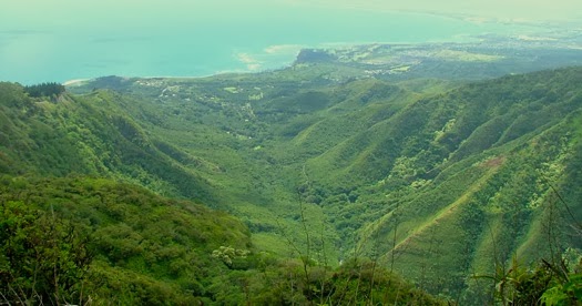
The West Maui Mountain’s highest peak, Puʻu Kukui, towers 5,788-feet; it is one of the wettest spots on earth (average yearly rainfall at the rain gage since 1928 is about 364-inches.) The rain carved out valleys on either side, one of these, ʻĪao Valley ("cloud supreme,") has a narrow entrance facing toward Wailuku that opens into a much larger expanse in the back.
For centuries, high chiefs and navigators from across the archipelago were buried in secret, difficult-to-access sites in the valley’s steep walls.
ʻĪao valley in the West Maui Mountain is the first place mentioned in the historical legends as a place for the secret burial of high chiefs. Kapawa, the ruling chief of Hawaiʻi about 25-30 generations ago, was overthrown by his people, assisted, perhaps, by Pāʻao. (Westervelt)
His body was said to have been taken to ʻĪao and concealed in one of the caves of that picturesque extinct crater. From that time apparently this valley became a "hallowed burying place for ancient chiefs." (Westervelt)
For centuries, aliʻi (chiefs) were laid to rest in secret burial sites along the valley's steep walls. The practice of burying aliʻi in the valley began in the eighth century and reportedly continued until 1736, with the burial of King Kekaulike.
Commoners were not permitted into ʻĪao, except during the annual Makahiki festival, which was held on the grassy plateau above the Needle.
Then, in the late-1780s into 1790, Kamehameha conquered the Island of Hawai‘i and was pursuing conquest of Maui and eventually sought to conquer the rest of the archipelago. At that time, Maui’s King Kahekili and his eldest son and heir-apparent, Kalanikūpule, were carrying on war and conquered O‘ahu.
In 1790, Kamehameha travelled to Maui. Hearing this, Kahekili sent Kalanikūpule back to Maui with a number of chiefs (Kahekili remained on O‘ahu to maintain order of his newly conquered kingdom.)
“Kamehameha marched overland to Hāna. His army is said to have contained 16,000 men. Nelson's famous exhortation to his men at Trafalgar (1805) fifteen years later was: "England expects every man this day to do his duty," but Kamehameha's command to his battle-scarred veterans was: "Imua e nā pōkiʻi a inu i ka wai ʻawaʻawa" (Onward brothers until you taste the bitter waters of battle.)” (Mid-Pacific Magazine, January 1912)
After a battle in Hāna, Kamehameha landed at Kahului and then marched on to Wailuku, where Kalanikūpule waited for him. The ensuing battle was one of the hardest contested on Hawaiian record. The battle started in Wailuku and then headed up ‘l̄ao Valley – the Maui defenders being continually driven farther up the valley.
Kamehameha ordered his army to advance, the Maui army met the invaders, but the Maui defenders were so powerless in the face of musketry that they retreated up the valley with the Kamehameha army following them.
Kamehameha's superiority in the number and use of the newly acquired weapons and canon (called Lopaka) from the ‘Fair American’ (used for the first time in battle, with the assistance from John Young and Isaac Davis) finally won the decisive battle at ‘Īao Valley.
The Maui troops were completely annihilated, and it is said that the corpses of the slain were so many as to choke up the waters of the stream of ‘l̄ao - one of the names of the battle was "Kepaniwai" (the damming of the waters.) Kalanikūpule fled.
Kamehameha left for Moloka‘i to secure it under his control, and there received Keōpūolani as his wife. Then, in 1795, Kamehameha moved on in his conquest of O‘ahu, meeting and defeating Kalanikūpule, at Nuʻuanu.
Visiting Wyoming Senator Clark once declared ʻĪao Valley to be the Yosemite of Hawaiʻi. “These words of adulation were not inspired by momentary flattery, for many others who have feasted their eyes on that famous place, thousands of miles away, were also of the same opinion.” (Mid-Pacific Magazine, January 1912)
“In order to properly understand the significance of the Yosemite Valley or any of the well-traveled picturesque places of the mainland, there is always some historical fact attached to give added interest.”
“We all know that the Yosemite is named after an enormous grizzly bear who made his last stand against the Indians in the fastnesses about the celebrated falls. And so it is in Hawaiʻi, nearly every one of the beautiful and sometimes overpowering pieces of scenery is associated with some historical fact that gives food for thought.“ (Overland Monthly, July 1909)
A hundred years ago, visitors had the opportunity to travel to the back of the ʻĪao, “After leaving the needle, the traveler crosses the stream, and up the narrow, winding path leading to the plateau several hundred feet above. This table land is called Kaalaholo. Around its entire base gently flows streams of pure, crystal-like, mountain water.”
“When the top is reached the visitor views a scene so grand, inspiring and majestic that its equal cannot be found within the bounds of the Hawaiian Islands. It is beautiful beyond comparison.”
“Imagine oneself standing at the bottom of a huge basin four miles wide and about five miles long, and looking up with awe at the crest of the Iao mountains above, rising to a height of five thousand feet. The circumference of the ridges which encompass Iao Canyons is about twenty miles.”
“They rise up perpendicular all around and are inaccessible except in a few places. And from the summits of these tall, lofty precipices, called "Palilele-o-Koae," or the home of the seabirds, play myriads of tiny waterfalls in mid-air, which as they reach the bottom, form part of the mighty stream.” (Mid-Pacific Magazine, January 1912)
From the present viewing area within the State Monument at ʻĪao (and in all the photos showing the valley,) you can see Kūkaʻemoku (more commonly called ‘Iao Needle.) From this perspective, Kūkaʻemoku appears to stick up from the valley floor like a ‘needle,’ thus its modern name.
Actually, what people see is a bump on a side-ridge on the right-side of ʻIao Valley with a large protrusion that sticks up on top; it stands about 1,200-feet tall. It looks like a ‘needle’ of rock, but really isn’t (it’s part of the ridge.)
The Valley and volcanic rocks within it were selected to serve as a National Natural Landmark (1972.) It also serves as a Hawaiʻi
Monument operated under DLNR’s State Parks system. It is at the end of ‘Īao Valley Road (Highway 32.) Free parking for Hawai‘i residents, $5 per car for others (open 7 am to 7 pm.)
The photos show Kūkaʻemoku (“ʻĪao Needle”) – the viewing area perspective and a bit of a side view (alexinwanderland.) In addition, I have included other images in a folder of like name in the Photos section on my Facebook and Google+ pages.
Follow Peter T Young on Facebook
Follow Peter T Young on Google+
Follow Peter T Young on LinkedIn
© 2014 Hoʻokuleana LLC
Sunday, February 9, 2014
Battle of Kalaeʻiliʻili
In Europe, Great Britain defeated France in the Seven Years' War (1756-1763,) becoming the dominant power in Europe, North America and India. The war cost a lot of money; to raise funds Britain decided to levy taxes on the Colonies on the American continent.
For instance, the passed Quartering Act (required the colonies to provide barracks and supplies to British troops;) Stamp Act (taxed newspapers, almanacs, pamphlets, broadsides, legal documents, dice and playing cards;) Sugar Act (increased duties on non-British goods shipped to the colonies) and Currency Act (prohibited American colonies from issuing their own currency.)
This marked the beginning of Colonial opposition to the British (1765) and Colonists cried out against ‘taxation without representation.’
Turmoil was in the Islands, as well – some folks on Maui were also feeling that they were not being treated fairly; in addition, a power struggle was emerging.
Wailuku was considered a Royal Center (politically, ceremonially and geographically important during traditional times) with many of the chiefs and much of the area’s population residing near or within portions of ‘Īao Valley and lower Wailuku. (FWS)
The period immediately preceding contact with the Europeans was one of considerable upheaval and conflict. (FWS)
After the death of Kamehamehanui (the late king of Maui,, which happened about 1765, Nāmāhana (the widow queen of Kamehamehanui) married Keʻeaumoku. (Fornander)
Nāmāhana’s brother, Kahekili, then became King of Maui, was displeased that Nāmāhana had taken Keʻeaumoku for her husband, and he became Keʻeaumoku's enemy.
Nāmāhana and Keʻeaumoku lived at the large and fertile land of Waiheʻe.
Some people on Maui felt that the abundance of resources would have allowed all to be well fed; they felt they were not getting their share.
In particular, Kahanana (at the time, a lesser chief in Waiheʻe) was neglected by Keʻeaumoku and his court when the chief of Waiheʻe distributed fish, after fortunate catches, among the subordinates and warriors living on the land. (Fornander)
Kalākaua writes that “Kahekili induced Kahanana … to embroil Keʻeaumoku in a difficulty with his own people.”
One evening Kahanana killed three of Keʻeaumoku’s men. An insurrection arose and Kahekili, who was in the vicinity, took the side of Kahanana.
The resultant Battle of Kalaeʻiliʻili (c. 1765) was fought because the rich agricultural resources of the Waiheʻe River Valley and the offshore marine resources were being unevenly distributed by the chief Keʻeaumoku and other Molokaʻi chiefs.
A general fight ensued between the Kahanana party, being supported by Kahekili, and Keʻeaumoku. Keʻeaumoku and his chiefs maintained their ground for some days, but were eventually overmatched, beaten and obliged to flee. (Fornander)
The Battle reportedly marked the beginning of Kahekili’s reign and Keʻeaumoku and the Molokaʻi chiefs were driven out of Waiheʻe.
But the anger of Kahekili pursued the fugitives. Invading Molokaʻi, he engaged Keʻeaumoku and his Molokaʻi allies in a sea-fight and Kahekili was again victorious. The naval engagement off Molokaʻi is called the battle of "Kalauonakukui." (Fornander)
Keʻeaumoku fled to Hāna, where Mahihelelima, the governor under Kalaniʻōpuʻu, received him and his wife and entertained them at Kaʻuiki. (Fornander)
At Kaʻuiki, Keʻeaumoku appears to have found a short repose in his turbulent career; he was not heard of again for some years. It is probable that he made his peace with Kalaniʻōpuʻu and was permitted to remain at Hāna. (Fornander)
It was later, there at Kaʻuiki, Hāna, Maui, in about 1768, that Keʻeaumoku and his wife Nāmāhana had their first child, Kaʻahumanu, future and famous Queen of Kamehameha the Great.
Again, several years pass by with Kalaniʻōpuʻu still holding portions of the Hāna district on Maui and the great fort of Kaʻuiki; but about the year 1775, the war between Hawaiʻi and Maui broke out again. (Fornander)
Kahekili successfully defended his capital in Wailuku throughout the 1770s, until his defeat at the hands of Kamehameha’s forces. (FWS) (Kamehameha went on to conquer the Islands of Hawaiʻi, Maui Nui and Oʻahu by 1795 (defeating Kalanikūpule, Kahekili’s son) and ultimately ruled the island chain in 1810.)
Back on the continent, the discontent between the Colonists and the British Crown led to the American boycott of taxed British tea and the Boston Tea Party in 1773, and ultimately the American Revolutionary War (1775–1783) and then the War of 1812.
The image shows Waiheʻe Valley from Waiheʻe Ridge Trail. In addition, I have included other related images in a folder of like name in the Photos section on my Facebook and Google+ pages.
Follow Peter T Young on Facebook
Follow Peter T Young on Google+
© 2014 Hoʻokuleana LLC
Labels:
Hana,
Hawaii,
Kaahumanu,
Kahanana,
Kahekili,
Kalaniopuu,
Kauiki,
Keeaumoku,
Maui,
Namahana,
Waihee,
Wailuku
Monday, January 20, 2014
Kanuimanu (Keālia Pond)
The Island of Maui formed from two shield volcanoes that were close enough that their lava flows overlapped, forming an isthmus between them.
The oldest volcano, that formed the West Maui Mountain, is about 5,000-feet high. The younger volcano, Haleakalā, on the east side of the island is over 10,000-feet high.
The isthmus that separates the two volcanic masses is formed from erosional deposits and is the prominent topographic feature for which the island is known: “the Valley Isle.”
Keālia was once an ancient fishpond supplied with water from the Waikapū Stream in the West Maui Mountain and Kolaloa Gulch originating from Haleakalā.
Native Hawaiians may have raised awa (milkfish) and ʻamaʻama (flathead mullet) using a system of ditches and sluice gates to let nearby fish from Māʻalaea Beach into the pond.
Established in 1992, Keālia Pond National Wildlife Refuge encompasses approximately 700-acres and is one of the few natural wetlands remaining in the Hawaiian Islands. Located along the south-central coast of the island of Maui, between the towns of Kīhei and Māʻalaea. (USFWS)
A new visitor center (2012) with exhibition hall and staff offices, replacing a trailer, was dedicated and is in use at the Wildlife Refuge. This, with the coastal boardwalk and interpretive signage, gives a great opportunity to see and learn about the Wildlife Refuge.
Seasonal conditions that occur at Keālia Pond National Wildlife Refuge make it a notable place for people to observe Hawai‘i's endangered wetland birds, along with a diversity of feathered visitors from as far away as Alaska and Canada, and occasionally from Asia. (USFWS)
At the turn of the century, about 40,000-ducks wintered in Hawaiian wetlands; today, that number is around 2,000. Four of the five native water birds are now classified as endangered.
Keālia Pond serves as a settling basin a 56-square mile watershed that results in seasonal intermittent flooding during winter months and dryer conditions during late summer months.
This creates open water (200-acres) and shallow mud flat areas interspersed with vegetation, which provide suitable resting, feeding, and nesting habitat for endangered water birds. During certain times of the year, the refuge supports at least half of the Hawaiian stilt population.
The pond also supports a diverse group of migratory birds from late summer (August) to early spring (April). It is one of the most important areas in the state for wintering migratory waterfowl.
Migratory shorebirds also congregate here to take advantage of the food resources along the water's edge. As water recedes, fish are crowded into the remaining water, making them easy prey for ʻaukuʻu (black-crowned night herons).
Baitfish ponds were constructed in the early-1970s for aquaculture of baitfish species; however, the use of these ponds for waterbirds was minimal because of the thick coverage of nonnative, invasive plants on the levees and within the ponds.
This wetland is home to the endangered aeʻo (Hawaiian stilt) and ʻalae keʻokeʻo (Hawaiian coot.) The refuge is adjacent to Keālia Beach, which is a nesting ground for the endangered hawksbill turtle. (USFWS)
The aeʻo adult males and females are mostly black above and white below, with a long, thin black bill and long pink legs. Found generally across the Islands, they also call Keālia home.
The total aeʻo population is estimated to be between 800 to 1,100 birds, depending on the amount of rainfall in any given year. Wetlands are essential for natural foraging areas to feed juveniles. (Goody, WHT)
With between 1,500 and 3,000 individuals, Maui’s Keālia Pond National Wildlife Refuge and Kanaha Pond Wildlife Sanctuary have the second largest population of ʻalae keʻokeʻo in the state (O‘ahu is first).
The ʻalae keʻokeʻo is dark slate gray with a white bill and a large frontal shield (extension of bill onto forehead). The frontal shield is white but some sport a small red dot which is not related to sex or age. ʻAlae keʻokeʻo have white undertail feathers that are visible when adults are defending their territory and during courtship displays. (Lots of information here from USFWS.)
The image shows Keālia Pond Visitor Center sign (MauiNews.) In addition, I have added other related images in a folder of like name in the Photos section on my Facebook and Google+ pages.
Follow Peter T Young on Facebook
Follow Peter T Young on Google+
© 2014 Hoʻokuleana LLC
Saturday, January 11, 2014
Nā Wai ʻEhā
Maui is the second largest of the Hawaiian Islands, and covers about 730 square miles. Maui consists of two separate volcanoes with a combining isthmus between the two.
The Mauna Kahālāwai (West Maui Mountain) is probably the older of the two; Haleakala (East Maui) was last active about 1790, whereas activity on West Maui is wholly pre-historic.
Nā Wai ʻEhā ("The Four Great Waters") – Waiheʻe River, Waiehu Stream, Wailuku (ʻĪao) Stream and Waikapū Stream are in central Maui.
The headwaters of Waine’e and ‘Īao extend to or near the summit of the Mauna Kahālāwai at Pu‘u Kukui and are among the largest streams, in terms of stream flow, on Maui.
The headwaters of N & S Waiehu Streams are cut off from the summit area by the valleys of Waine’e River to the north and ‘Īao Stream to the south, they later merge to form Waiehu Stream. Waikapū Stream is the only Nā Wai ‘Ehā stream that drains to the southern coast of Maui.
The abundance of water in Nā Wai ʻEhā enabled extensive loʻi kalo (wetland kalo) complexes, including varieties favored for poi-making such as “throat-moistening lehua poi.” (CWRM)
Nā Wai ʻEhā once “comprised the largest continuous area of wetland taro cultivation in the islands.” Its “complex agricultural system of wetland kalo cultivation,” together with the abundant protein sources in the streams and nearshore waters, supported one of the largest populations on Maui.
The fertile kalo lands, complex system of irrigation ʻauwai (ditches) and abundant fresh water from Nā Wai ʻEhā sustained Hawaiian culture for 1,000-years.
In addition to extensive agricultural production, other practices thrived in Nā Wai ʻEhā, including the gathering of upland resources, such as thatch and ti, and protein sources from the streams, including ʻoʻopu (goby fish,) ʻōpae (shrimp) and hihiwai (snail.)
The waters of Nā Wai ʻEhā were renowned for the practice of hiding the piko, or the umbilical cord of newborn babies. “(T)he spring ʻEleile contained an underwater cave where the people of the area would hide the piko of their babies after birth.” This practice affirms the individual’s connection to the land.
The practice of hiʻuwai, also known as kapu kai, often occurred here around the time of makahiki, when individuals “would go into the rivers or into the ocean in order to do a cleansing for the new year”.
This type of cleansing, which required immersion in the water, was also conducted “before you start or end certain ceremonies”. For ceremonies dedicated to Kāne, “having a hiʻuwai in a stream magnifies the mana”.
Given the makeup of the Nā Wai ʻEhā, Waiheʻe River and ‘Īao historically would have flowed continuously to the coast; Waiehu Stream would have flowed continuously to the coast at least 95 percent of the time; and Waikapū Stream would have flowed continuously to the coast less than half of the time. (USGS)
But the streams were diverted, to quench the thirst of the thirsty sugar plantations.
By 1866, a letter published in the Hawaiian language newspaper Nūpepa Kūʻokoʻa lamented “the current condition of once cultivated taro patches being dried up by the foreigners, where they are now planting sugar cane”.
These diversions and ditch systems historically supplied two sugar plantations: Wailuku Sugar and Hawaiian Commercial & Sugar Company (HC&S,) which belonged to the plantation-era “Big Five” companies C. Brewer and Alexander & Baldwin, respectively.
Wailuku Sugar was organized in 1862 by James Robinson, Thomas Cummins, J Fuller and agent C Brewer. In 1878, through his friendship with King Kalākaua, Claus Spreckels secured a lease of 40,000-acres of land on Maui and by 1882 he founded the Hawaiian Commercial Company (later known as Hawaiian Commercial & Sugar Company – HC&S.)
This quickly became the largest and best-equipped sugar plantation in the islands (in 1898, Spreckels lost control of HC&S and Alexander & Baldwin took over as agents at that time.)
Water wars have been waged way back.
Back in 1882, Wailuku Sugar and Spreckels fought over portions of the ditch system and purported rights to the water in the streams.
Lately, complaints were filed by downstream users arguing public trust, traditional and cultural practices (including kalo farming.) In part, the diversions and ditches are capable of diverting all of the dry-weather flow available at the intakes – and often times, downstream conditions resulted in dry streambeds.
More recently (March 13, 2008,) the State Commission on Water Resource Management designated Nā Wai ʻEhā a surface water management.
In addition, on August 15, 2012, the Hawaiʻi Supreme Court vacated a Water Commission decision and that included instream flow standards.
Instream Flow Standard is “a quantity or flow of water or depth of water which is required to be present at a specific location in a stream system at certain specified times of the year to protect fishery, wildlife, recreational, aesthetic, scenic, and other beneficial instream uses.”
The technical language of the law is complicated; I simplify this to say that the instream flow standard allows a stream to be a stream. (Lots of information here is from associated court papers and descriptions.)
The image shows a map of Nā Wai ʻEhā (CWRM.) I added a couple of other images in a folder of like name in the Photos section on my Facebook and Google+ pages.
Follow Peter T Young on Facebook
Follow Peter T Young on Google+
© 2014 Hoʻokuleana LLC
Monday, August 19, 2013
Kaʻahumanu Church
The church began on August 19, 1832; the first services were held under a thatched roof.
The present Kaʻahumanu Church is actually the fourth place of worship for the Wailuku congregation. The original congregation, under the leadership of the Reverend Jonathan S Green, was forced to hold their meetings in a shed.
During its first year, Queen Kaʻahumanu, the Kuhina Nui of the Kingdom and convert to Christianity, visited the congregation and asked that when the congregation built an actual church, it be named for her.
Queen Kaʻahumanu was Kamehameha’s favorite wife. She was, at one time, arguably, the most powerful figure in the Hawaiian Islands, helping usher in a new era for the Hawaiian kingdom.
When Kamehameha died on May 8, 1819, the crown was passed to his son, Liholiho, who would rule as Kamehameha II.
Kaʻahumanu created the office of Kuhina Nui (similar to premier, prime minister or regent) and would rule as an equal with Liholiho. She ruled first with Kamehameha II until his departure for England in 1823 (where he died in 1824) and then as regent for Kauikeaouli (Kamehameha III).
Ka‘ahumanu assumed control of the business of government, including authority over land matters, the single most important issue for the Hawaiian nation for many generations to come. She later married Kauaʻi’s chief, Kaumualiʻi, who Kamehameha I had made a treaty with instead of fighting and thereby put all the islands under single control.
On December 4, 1825, Queen Kaʻahumanu was baptized and received her new name, Elizabeth, then labored earnestly to lead her people to Christ.
The congregation’s small shed meeting house soon proved too small as the service held there attracted as many as 3,000 worshippers. In 1834, a larger meeting house with a thatched roof was erected by the congregation.
The Reverend Richard Armstrong who had replaced the Reverend Green as pastor in 1836, supervised the construction of two stone meeting houses one at Haiku, and the other at Wailuku. The new Wailuku Church, completed in 1840, was 100 feet by 52 feet, and was two stories (actually one story and a gallery) in height. Reverend Green returned to replace Armstrong in 1840.
In 1843, the Reverend Green was replaced by the Reverend EW Clark. Five years later, Clark was transferred to Kawaiahaʻo Church in Honolulu, and the Reverend Daniel Conde took over the pastorate at Wailuku. Later, Reverend WP Alexander became pastor.
Active fundraising under Pastor William Pulepule Kahale led to the opportunity to finally build a permanent church. Under the direction of Reverend Edward Bailey, in May, 1876, the new church, finally named the Kaʻahumanu Church, was completed.
Only a rock retaining wall that borders High Street in Wailuku is what remains of the old church.
The Kaʻahumanu Church is a large blue stone structure with wall more than two feet thick. It has a high-pitched gable roof with no overhang, but the eave terminates in a small molding adjacent to the top place along the wall.
The exterior is finished in plaster. The church tower was not added until 1884 with a "fine tower clock from the U.S. costing $1,000." In 1892 the chandeliers were added to the interior.
The structure is four bays in depth with each bay having a single tall Gothic arched window with the interior of the window opening splayed. Windows are multi-paned, double-hung wood frame with simple pattern in the upper part of the arch.
Adjoining the church is Honoliʻi Park. It is believed that John Honoliʻi, a Native Hawaiian who had studied at Cornwall, Connecticut with Henry ʻŌpūkahaʻia and later sailed aboard the brig Thaddeus with the original Protestant missionaries in 1820, is buried in an unmarked grave in the Kaʻahumanu Church cemetery. (Honoliʻi died in 1838.)
Although not a part of the neighboring historic district the Kaʻahumanu Church adjoins several other historic structures that make up the Wailuku Historic District. Click HERE for some more information on those properties.
The image shows the present Kaʻahumanu Church in Wailuku. I have added other images to a folder of like name in the Photos section on my Facebook and Google+ pages.
Follow Peter T Young on Facebook
Follow Peter T Young on Google+
© 2013 Hoʻokuleana LLC
Monday, October 15, 2012
Bailey House, Wailuku, Maui
The Bailey House was originally built as a parsonage for the ministers of the Wailuku Church. The house is a combination of four structures built between 1835 and 1850.
The original portion was built in 1833 by Reverend Jonathan Green and is a two-story lava stone structure measuring approximately 30’ x 20’ with 20” thick walls. A high pitched gable roof is covered with wood shingles.
At about the same time (1833), a single story lava stone cookhouse was constructed slightly uphill from the living area. The single room is dominated by a large fireplace and oven flush with the interior wall. The mass of the oven structure projects beyond the north wall.
The lower floor is built partially into the side of a hill with the walls retaining the earth on the uphill side.
In 1837 a single story lava stone structure with a basement was built for Miss Ogden, a teacher for the girls' school in Wailuku.
Edward Bailey was a Protestant missionary from Holden, Massachusetts. Prior to their marriage, Edward attended Amherst College and Caroline was a tailoress.
He and his wife Caroline Hubbard Bailey sailed from Boston on the barq, ‘Mary Frazier,’ on December 14, 1836. They arrived in Honolulu April 9, 1837.
They were married only two weeks when they left Massachusetts. Caroline was pregnant with son Edward upon their arrival in Hawaii.
Not long after their arrival, the couple was transferred to Wailuku to head the Wailuku Female Seminary in 1837. The Seminary was the counterpart to the boy’s institution at Lahainaluna, serving some 50 girls age five to 12.
Seminary girls learned the traditional lessons in Hawaiian and were also taught to sew, spin and crochet. They also would work an hour a day in their own garden plots.
Bailey worked at the Wailuku Female Seminary in Maui from 1840 until its closure in 1849. At that time he purchased a fee simple title to the Girls' boarding school, the house and lot, and began his interest in what was to become Wailuku Sugar Company.
As noted by Mary Brewster in 1847, “Mr. Bailey has a very fine house with a beautiful garden handsomely laid and of considerable extent. T he most beautiful place I have ever seen.”
“All kinds of trees such as the fig, banana, guava, citron and a number of our own species which he is trying to cultivate. Flowers of all kinds which will grow here with exotics, vines, and shrubs, all displaying much taste in their arrangements.”
Because of his growing family, Bailey added two rooms upstairs in 1850 and had the entire house re-roofed.
After the seminary closed, he built the still-standing Ka'ahumanu Church in Wailuku and operated a small sugar plantation. He designed and built a water powered mill for sugar and wheat in Wailuku. The business developed into the Wailuku Sugar Company. He was also an active participant in starting the Haiku Sugar Company.
Over his years in Hawaiʻi, Baily taught music. He aided in the practice of medicine, although he had no medical degree. He created the girls school in Makawao known as Maunaʻolu Seminary.
He surveyed native kuleana and built the first bridge over the Wailuku River. He designed the Lahainaluna token currency.
He began painting about 1865, at the age of 51, without any formal instruction; he was the most accomplished of the missionary artists in Hawaii. He painted landscapes in oil.
Edward and Caroline lived in their Wailuku home for 50-years, then they and their sons (other than Edward Jr. who was married to Emily Kania) moved to California in 1885, possibly 1888.
At the time of his death in 1903 Edward Sr. was the oldest living missionary sent to Hawaii between 1820 - 1850 by the American Board of Commissioners for Foreign Missions .
The Bailey House is now the Maui Historical Society’s Hale Hō‘ike‘ike (House of Display) showcasing Hawaiian history and culture, as well as paintings and furnishings from nineteenth-century Maui.
The image shows the Bailey House; in addition, I had added other images of the property in a folder of like name in the Photos section on my Facebook page.
http://www.facebook.com/peter.t.young.hawaii
© 2012 Hoʻokuleana LLC
Thursday, September 20, 2012
Wailuku Civic Center Historic District
The Wailuku Civic Center Historic District is comprised of several buildings (recognized on the State and National Registers of Historic Places) that generally front on South High Street and constitute the core of governmental structures in Wailuku, the Maui County seat.
Following annexation, the Territorial government passed the County Act in 1905, establishing county governments on the four largest islands in the Hawaiʻi chain.
The act named Wailuku the County seat of Maui, although a number of people were advocating that Lāhainā, the former capital of the Hawaiian Kingdom, be accorded this right.
The citizens of east and central Maui, who comprised three quarters of the island's population, reasonably argued that with the growth and dominance of sugar production on the island, Wailuku had replaced Lāhainā as Maui's center of wealth, business and population.
Wailuku originally was a Hawaiian settlement. In 1832, a mission was established there under the leadership of Jonathan S. Green.
Very little development occurred, however, until after the Wailuku Sugar Company commenced its operations in 1862. This led to the growth and eventual prosperity of the town.
Following the naming of Wailuku as Maui's County seat, the first substantial government building erected in the town was the district courthouse.
The county government remained housed in leased commercial space, a small wooden office building and the community hall, until 1925 when the current Police Station was built to accommodate the demand for adequate office space.
The construction of this building was hailed by the local press as, "another step in the establishment of an attractive civic center," and the writer looked forward to the day when, "all the civic needs will be appropriately housed in one center."
The construction of the public library in 1928 was another step in reaching this desired goal, and the Territory's decision to purchase a corner of the property owned by Kaʻahumanu Church for the construction of the Territorial Office Building in 1930, assured the civic center.
The buildings within the district house State and County government offices, courts, and the public library, and serve as a hub of governmental activity for the island of Maui.
Built within a twenty-four year period, the historic structures represent the architectural aspirations of their time, employing the popular Beaux Arts revival, Mediterranean revival and Hawaiian styles.
These buildings are all of masonry construction and of one or two stories in height, which is in keeping with the scale of most of the city.
The oldest of the buildings is the County Courthouse, erected in 1907. Designed by Honolulu architect H. L. Kerr, it is a Beaux Arts inspired building constructed of cast hollow concrete block which mimetically perpetuates dressed stone.
Next to, and set back from, the Courthouse is the County Office Building, a nine-story building constructed in 1972.
Standing on the other side of the County Office Building is The Police Station. Built in 1925, this reinforced concrete building was designed in a simple Mediterranean style by Maui architect William D’Esmond.
Across South High Street on either corner of the intersection with Aupuni Street stand the Wailuku Library (completed in 1928) and the former Territorial Building (completed in 1931, it now houses the State's judiciary.) Both of these Mediterranean revival/Hawaiian style buildings were designed by CW Dickey.
Other sites in the vicinity, but not part of the formal “Historic District” include Halekiʻi - Pihana Heiau, Kaʻahumanu Church and Hale Ho‘ike‘ike/Old Bailey House.
Haleki‘i and Pihana Heiau are the most accessible of the remaining pre-contact Hawaiian structures of religious and historical importance in the Wailuku-Kahului area; they are located along the west side of Iao Stream.
Traditional history credits the menehune with the construction of both heiau in a single night; other accounts say they were built under the rule of Kahekili.
In 1832, Queen Kaahumanu visited a religious service by Jonathan Smith Green, and later requested that a more permanent church structure be named for her; ultimately, Reverend Edward Bailey fulfilled her request in 1876 when the current structure was built.
Hale Ho‘ike‘ike, the Old Bailey House, is a combination of four structures built between 1835 and 1850. Originally built as a parsonage for the ministers of the Wailuku Church, it’s now operated by the Maui Historical Society as a museum.
The image shows building within the Wailuku Civic Center Historic District-Top row, left to right-Courthouse, Old Police Station; Bottom row, left to right-Wailuku Library, Territorial Building.
In addition, other images of these and other historic buildings/sites in the vicinity are in a folder of like name in the Photos section on my Facebook page.
http://www.facebook.com/peter.t.young.hawaii
© 2012 Hoʻokuleana LLC
Subscribe to:
Posts (Atom)