Showing posts with label Hana. Show all posts

Friday, March 6, 2015

Georgia O’Keeffe


James Drummond Dole founded Hawaiian Pineapple Company in 1901. The ad agency for Dole was looking for something special for a national magazine advertising campaign; in exchange for an all-expense-paid trip, they asked Georgia O’Keeffe to submit two paintings from Hawai‘i. O’Keeffe became one of the greatest female artists of the 20th century. Best known for her still-life paintings, she painted natural settings at their most basic: large-scale flowers, bones and landscapes.

In Hawaiʻi, she was hosted by the Willis Jennings family (he was manager of the Hāna sugar plantation;) twelve-year-old Patricia Jennings became her companion and guide for the next ten days.  O’Keeffe had produced 20-paintings, not one included a pineapple and she subsequently “submitted depictions of a papaya tree and the spiky blossom of a lobster’s claw heliconia” for the Dole ads.

Click HERE for the full post and images.


Tuesday, July 29, 2014

ʻOheʻo


Although the canoe was a principal means of travel in ancient Hawaiʻi, extensive cross-country trail networks enabled gathering, harvesting other necessities for survival.

Famed for his energy and intelligence, King Piʻilani and his son Kiha constructed the legendary Alaloa or long trail known as the King’s Highway.

It was built about the time Christopher Columbus was crossing the Atlantic, before there were roads in Hawaiʻi.  Back then, they were trails and Piʻilani was ruler of Maui.

According to oral tradition, Piʻilani unified the entire island of Maui, bringing together under one rule the formerly-competing eastern (Hāna) and western (Wailuku) multi-district kingdoms of the Island.   Piʻilani ruled in peace and prosperity.

Four to six feet wide and 138-miles long, this rock-paved path facilitated both peace and war.  It simplified local and regional travel and communication, and allowed the chief’s messengers to quickly get from one part of the island to another.  The trail was used for the annual harvest festival of Makahiki and to collect taxes, promote production, enforce order and move armies.

The southeastern section of the island of Maui, comprising the districts of Hāna, Kīpahulu, Kaupo and Kahikinui, was at one time a Royal Center and central point of kingly and priestly power – Piʻilani ruled from here (he built Hale O Piʻilani – near Hāna.)  This section of the island was also prominent in the later reign of Kekaulike.

Royal Centers were where the aliʻi resided; aliʻi often moved between several residences throughout the year. The Royal Centers were selected for their abundance of resources and recreation opportunities, with good surfing and canoe-landing sites being favored.

Long before the first Europeans arrived on Maui, Kīpahulu was prized by the Hawaiian aliʻi for its fertile land and abundant ocean.  The first written description of the region was made by La Pérouse in 1786 while sailing along the southeast coast of Maui in search of a place to drop anchor:

“I coasted along its shore at a distance of a league (three miles) …. The aspect of the island of Mowee was delightful.  We beheld water falling in cascades from the mountains,  and running in streams to the sea,  after having watered the habitations of the natives,  which  are  so numerous  that a  space of  three or four leagues (9 – 12 miles, about the distance from Hāna to Kaupō) may be  taken for  a single village.” (La Pérouse, 1786; Bushnell)

“But all the huts are on the seacoast, and the mountains are so near, that the habitable part of the island appeared to be less than half a league in depth.  The trees which crowned the mountains, and the verdure of the banana plants that surrounded the habitations, produced inexpressible charms to our senses…”

“… but the sea beat upon the coast with the utmost violence, and kept us in the situation of Tantalus, desiring and devouring with our eyes what it was impossible for us to attain … After passing Kaupō no more waterfalls are seen, and villages are fewer.” (La Pérouse, 1786; Bushnell)

With the development of the whaling industry on the island in 1880s the southeastern Maui population started to decline as people moved to main whaling ports, such as Lāhainā.  In the early-1900s, one of the regular ports of call for the Inter-Island Steam Navigation Company was here at Kīpahulu. Steamships provided passenger service around Maui and between the islands.

Kīpahulu Landing also provided a way for growers and ranchers to ship their goods to markets. (Today the land where Kīpahulu Landing existed is private but protected with a conservation easement, overseen by the Maui Coastal Land Trust (now part of the Hawaiian Islands Land Trust.))

The Hāna Sugar Plantation, formed in 1864, gradually increased production by expanding cane plantings toward Kīpahulu Valley.  (Cusick)

However, shortly after World War II, Paul I Fagan, an entrepreneur from San Francisco, bought the Hāna Sugar Co, formed a ranch and started tourism on this part of Maui.

It had been only 20-years since Hāna was linked to the outside world by a rough dirt road, and it would be almost two decades more before it was paved.

In 1946, Fagan built a small six-room inn, called Kaʻuiki Inn (it was later expanding and is now the Travaasa Hotel Hana.) Fagan’s guests consisted of his friends as well as sportswriters, one of which gave Hana the current name of “Heavenly Hana.”  (Maui College)

Near here was ʻOheʻo; here was a succession of several waterfalls tumbling from one pool into another and so on up the gulch.  (One interpretation of the name Oheo is “moving origin” – suggesting all pools as one (Yardley.))

In order to entertain guests and promote tourism in East Maui, employees at Fagan’s Inn crafted a legend that these pools had been reserved exclusively for Hawaiian Royalty and, therefore, were considered a sacred site.  (Cusick)

Billed as Hawaiʻi’s “Seven Sacred Pools” to attract tourists, ʻOheʻo Gulch actually has a series of 24 bowls that carry water down the slopes of 10,023-foot Mount Haleakalā to the sea.  (NY Times)

Then in the 1960s, Kīpahulu residents Charles Lindbergh and Sam Pryor, and philanthropist Laurance Rockefeller, concerned that public use of this area may be lost, worked to protect it.  Through their efforts, Kīpahulu Valley and ʻOheʻo Gulch became the Kīpahulu District of Haleakala National Park on January 10, 1969.  (NPS)

This part of the Park is located about 15-minutes past Hāna town, near mile marker 42 on the Hāna Highway (Road to Hana) after it turns into Highway 31.   Attractions include the ʻOheʻo Pools, a car-accessible campground and several maintained trails, such as the four-mile Pipiwai Loop Trail to Waimoku waterfall.

The image shows some of the ʻOheʻo pools.  In addition, I have added some other images in a folder of like name in the Photos section on my Facebook and Google+ pages.

Follow Peter T Young on Facebook  

Follow Peter T Young on Google+    

Follow Peter T Young on LinkedIn  

© 2014 Hoʻokuleana LLC

Saturday, May 3, 2014

Wetland Taro


Wākea and Papa, sky-father and earth-mother, who by the ʻOpūkahonua lineage were half-brother and half-sister, were said to be the parents of islands, Hawaiʻi and Maui (and later Kauaʻi, Niʻihau, Lehua, and Kaʻula - the rest were added later.)  According to tradition, their first human offspring was a daughter, Hoʻohōkūkalani (to generate stars in the sky.)

Wākea seduced his daughter, Hoʻohōkūkalani.  Their first child was born prematurely; they named him Hāloa-naka (quivering long stalk.)  They buried him in the earth and from that spot grew the first kalo (taro) plant. The second child, named Hāloa in honor of his elder brother, was the first Hawaiian Aliʻi Nui and became the ancestor of all the Hawaiian people.

Thus kalo, which was the main staple of the people of old, is also the older brother of the Hawaiian race.

Traditions on the island of Oʻahu provide the names of a dynasty of ruling chiefs including Mā’ilikūkahi, around 1500 (about the time Columbus crossed the Atlantic.) Māʻilikūkahi is said to have enacted a code of laws in which theft from the people by chiefs was forbidden.

A son of Mā’ilikūkahi was Kalona-nui, who in turn had a son called Kalamakua. Kalamakua is said to have been responsible for developing large taro gardens in what was once a vast area of wet-taro cultivation on Oʻahu: the Waikiki-Kapahulu-Mōʻiliʻili-Mānoa area. The extensive pond fields were irrigated by water drawn from the Mānoa and Pālolo Valley streams and large springs in the area.

Other chiefs mentioned in Oʻahu traditions were associated with organizing activities in more systematic ways than those in times previous to them; one such high chief was Kākuhihewa.

Another great chief of Oʻahu, Kualiʻi, was famous for the kolowalu law: “If a man says, ‘I am hungry for food’ feed (him) with food, lest he hungers and claims his rights by swearing the kolowalu law by his mouth, whereby that food becomes free, so that the owner thereof must observe the law faithfully.”

In pre-contact (prior to Captain Cook) times, kalo played a vital role in Hawaiian culture. It was not only the Hawaiians’ staple food, but the cultivation of kalo was at the very core of Hawaiian culture and identity.

The early Hawaiians probably planted kalo in marshes near the mouths of rivers. Over years of progressive expansion of kalo lo‘i (flooded taro patches) up slopes and along rivers, kalo cultivation in Hawai‘i reached a unique level of engineering and sustainable sophistication.

Hawaiians knew the productive advantages of growing wetland taro and placed the greater effort in this area very early, when required to increase food production capabilities for the rapidly increasing number of people. By the time of Captain Cook's visits in 1778 and 1779, every large river valley in the islands contained many loʻi (pond fields,) and each was systematically irrigated by means of ditches delivering water to the fields spread throughout the valley.

Usually, water was fed into an irrigation ditch from a stream. A loose-rock dam built across the stream allowed water to flow between and over the top of the rocks to provide for farmers living downstream. The dam functioned to raise the water level just high enough at that point to permit water to flow into the ditch leading to the terraces.

In this way the amount and speed of the water could be controlled. If too much water was found to be flowing into the ditch, a few stones could be removed from the dam, thus lowering the water level and reducing the volume of water entering the ditch.

The speed of the flow of water into the pondfields was controlled by the length and slope of the ditch. By varying the length and grade of the ditch, its builders were able to maintain a constant and low-level gradient over variegated terrain. The flow through the pond fields was controlled by the height of the terraces.

Kalo lo‘i systems are typically a set of adjoining terraces that are typically reinforced with stone walls and soil berms. Wetland taro thrives on flooded conditions, and cool, circulating water is optimal for taro growth, thus a system may include one or more ʻauwai (irrigation ditches) to divert water into and out of the planting area.  (McElroy)

The ʻauwai construction and maintenance formed foundations around which an entire economy, class system and culture functioned.  The ʻauwai, lo‘i and the taro plant’s mythical and spiritual connections in Hawaiian society influenced individual and social activity within the ahupua‘a.  (Handy, HART)

The different representatives in the ahupuaʻa taking part in the work furnished men according to the number of kalo growers on each land.  (The quantity of water awarded to irrigate the loʻi was according to the number of workers and the amount of work put into the building of the ʻauwai.)

David Malo explained how a taro garden could keep a large number of people in vegetable food continuously:  “Some farmers did not plant a great deal at a time. They would plant a little, and after waiting a few months, they planted more land. So they continued to plant a little at a time during the months suitable for planting. The food did not all ripen at once, and by this plan the supply was kept up for a long time and they had no lack of food.”

On the question of the productivity of wet-land taro versus dry-land taro, some missionaries recorded their experiences and observations in 1847 and 1848. They helped answer the question: What number of people could be fed by one acre of land, of average quality in the district, if cultivated for kalo?

Rev. Armstrong suggested that there would be 'food enough for ten persons' on an acre of average taro land in Honolulu, that is, subsistence for ten persons.  “With proper management, kalo (taro) land needs no rest. So the natives tell me. Let the water be kept constantly upon it and the weeds cleared out and that is all that is needed. The kalo plants, however, must be changed every crop. It requires about a year to bring a crop of kalo to maturity.”  (Armstrong)

Rev. Johnson of Hanalei, Kauaʻi, a noted wetland taro-producing valley, suggested that 25 people subsist on an acre of good taro land.

Writing from his experiences on the well-watered windward side of Oʻahu, Rev. Parker wrote:  “An acre of kalo land would furnish food for from twenty to thirty persons, if properly taken care of. It will produce crops for a great many years in succession, without lying fallow any time.”

Rev. Bishop, writing from ʻEwa District on Oʻahu, suggested that 15-20 people could be fed from an acre of taro:  “Good kalo land, irrigated by water, improves by cultivation. It only requires time enough between crops to rot the weeds, which serve as manure.”

Rev. Emerson lived and worked in Waialua District on Oʻahu where several large rivers and numerous springs watered the land.

He wrote: “Twenty persons, I think can be fed on an acre of good kalo land. The land can generally be cultivated perpetually, if it has two or three months between each crop, in which to decompose the weeds which might grow during the time the kalo was ripening.”

“I have a large kalo patch that has not been left to rest one month at a time for fifteen years, and yet it produces as largely as fifteen years since. I presume the same parch was cultivated centuries before I knew it. It requires one year for kalo to come to maturity.”

In 6 to 12-months, depending upon plant variety along with soil and water conditions, the taro is generally ready to harvest. Each parent tuber produces from two to 15 ʻohā, side tubers of corms, up to 6 inches in diameter.

The Hawaiian concept of family, ‘ohana, is derived from the word ‘ohā (Fig., offspring, youngsters,) the axillary shoots of kalo that sprout from the main corm, the makua (parent.)  Huli, cut from the tops of mauka and ‘ohā are then used for replanting to regenerate the cycle of kalo production.

Taro or Kalo has been a traditional form of food sustenance and nutrition, particularly in ancient Hawaiian culture.  Reportedly, it is the world’s fourteenth most-consumed vegetable.  All parts of the plant are eaten, including poi, table taro (the cooked corm,) taro chips and luau leaf.

The foregoing information (primarily from Marion Kelly and Lilikalā Kameʻeleihiwa (with some help from some others to fill some gaps)) helps answer some of the When, Why, Where and How Much questions related to wetland taro farming.

The 22nd Annual East Maui Taro Festival is being held May 3-4, 2014.

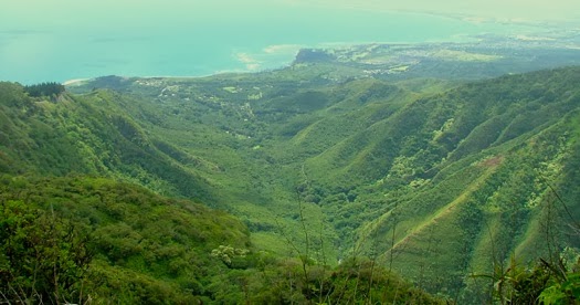
The image shows kalo (Markell.)  In addition, I have included more related images in a folder of like name in the Photos section on my Facebook and Google+ pages.

Follow Peter T Young on Facebook 

Follow Peter T Young on Google+ 

Follow Peter T Young on LinkedIn   

© 2014 Hoʻokuleana LLC

Saturday, April 19, 2014

Battle of Kalaeokaʻīlio


On April 19, 1775, the Battles of Lexington and Concord were the first military engagements of the American Revolutionary War.  The battles marked the outbreak of open armed conflict between the Kingdom of Great Britain and its thirteen colonies of British North America.

The first shot (“the shot heard round the world”) was fired just as the sun was rising at Lexington. The American militia was outnumbered and fell back; and the British regulars proceeded on to Concord.  Following this, the Continental Congress adopted the Declaration of Independence and it was signed by 56-members of the Congress (1776.)

The next eight years (1775-1783,) war was waging on the eastern side of the continent.  The main result was an American victory and European recognition of the independence of the United States (the war ended in 1873 with the signing of the Treaty of Paris.)

In the Islands, over the centuries, the islands weren’t unified under single rule.  Leadership sometimes covered portions of an island, sometimes covered a whole island or groups of islands.  Island rulers, Aliʻi or Mōʻī, typically ascended to power through familial succession and warfare. In those wars, Hawaiians were killing Hawaiians; sometimes the rivalries pitted members of the same family against each other.

Kalaniʻōpuʻu (Hawaiʻi Island ruler,) from the very beginning of his reign, made repeated attempts to conquer the neighboring island of Maui.  He held portions of the Hāna district and the Kaʻuiki fort in 1775, when, in the war between Hawaiʻi and Maui, he commanded a raid in the Kaupō district.  (Thrum)

In 1775, war between Hawaiʻi and Maui broke out at Kaupō on the island of Maui; it was the first battle that the rising warrior Kamehameha took part in.

While Kalaniʻōpuʻu was at Hāna he sent his warriors to plunder the Kaupō people. Kahekili was king of Maui at that time, when Kahekili’s warriors met those of Kalaniʻōpuʻu at Kaupō, a battle developed between the two sides.

The Hawaiʻi forces at Hāna, apparently under the command of Kalaniʻōpuʻu in person, raided the Kaupō district (that still acknowledged the rule of Kahekili.) Taken by surprise and unprepared, the Kaupō people suffered great destruction of property, cruelty and loss of life at the hands of the Hawaiʻi soldiers.  (Fornander)

When Kahekili heard of this he sent two detachments of soldiers to the relief of Kaupō. A battle ensued between the Hawaiʻi and Maui forces near Kalaeokaʻīlio Point, it became known as the Battle of Kalaeokaʻīlio (“The Cape of the Dog” - also called the War of Kalaehohea.)

Kalaniʻōpuʻu’s army was routed and retreated to their fleet, near at hand, and barely a remnant escaped on board and returned to Hāna.

“Among the warriors on the Hawaiʻi side in this battle of "Kalaeokaʻīlio" the legends make honourable mention of the valour of Kekūhaupiʻo, whose fame as a warrior chief stood second to none of his time.”  (Fornander)

“Kamehameha, afterwards famous in history, (also) figured prominently in this battle as having gallantly supported Kekūhaupiʻo”.  (Thrum) Despite the courageous fighting of Kamehameha and Kekūhaupiʻo along with the other Hawai‘i Island warriors, the massive Maui army of Kahekili eventually forces the Hawai‘i Island warriors to flee the battlefield.

Kekūhaupiʻo was Kamehameha’s teacher in the ancient martial arts.  Kekūhaupiʻo was determined to give all his knowledge to his chiefly pupil, and he indeed did so.  This brought about the firm bond between Kekūhaupiʻo and the young Kamehameha.

Kamehameha became the most skillful of all the chiefs in the use of the spear. Captain George Vancouver later wrote that he once saw six spears hurled at Kamehameha all at the same time.  Kamehameha caught three with one hand as they flew at him. Two he broke by hitting them with a spear in his other hand. One he dodged.  (Williams)

Kekūhaupiʻo is arguably the one man most closely connected to Kamehameha I during Kamehameha’s formative years, while he developed his skills as a warrior, and through the early period of Kamehameha’s conquests.

Outnumbered and overpowered, after this severe repulse, Kalaniʻōpuʻu went back to Hawaiʻi and made preparations for a revengeful invasion. This occupied a whole year.  (Thrum)

Kalaniʻōpuʻu promised revenge and, in 1776, he again went to battle against Kahekili. This battle (known as the Battle of Sand Hills or Ahalau Ka Piʻipiʻi O Kakaniluʻa) was recorded as one of the most bloody. Unfortunately, Kalaniʻōpuʻu was not aware of the alliance between Kahekili and the O‘ahu warriors under Kahahana, the young O‘ahu chief; Kalaniʻōpuʻu lost again.

Although often defeated, Kalaniʻōpuʻu managed to hold the famous fort of Kaʻuiki in Hāna for more than twenty years.  (Alexander)  At the time of Captain Cook’s arrival (1778-1779,) Kalaniʻōpuʻu was the chief reigning over the Island of Hawaiʻi and Hāna, Maui.

Kalaniʻōpuʻu returned to Hawaiʻi and met with Cook on January 26, 1779, exchanging gifts, including an ʻahuʻula (feathered cloak) and mahiole (ceremonial feather helmet.)   Cook also received pieces of kapa, feathers, hogs and vegetables.

In return, Cook gave Kalaniʻōpuʻu a linen shirt and a sword; later on, Cook gave other presents to Kalaniʻōpuʻu, among which one of the journals mentions "a complete Tool Chest."

After the departure of the Resolution and Discovery, Kalaniʻōpuʻu left the bay and passed to Kaʻū, the southern district of Hawaiʻi, having in his charge the young Kaʻahumanu. (Bingham)  Kalaniʻōpuʻu died in 1782; Kahekili died in 1794.

The image shows Kalaniʻōpuʻu, drawn by John Webber (1787.)  I added a couple of other images in a folder of like name in the Photos section on my Facebook and Google+ pages.

Follow Peter T Young on Facebook  

Follow Peter T Young on Google+    

Follow Peter T Young on LinkedIn   

© 2014 Hoʻokuleana LLC

Friday, February 21, 2014

Nāhiku Rubber Company


Nāhiku comes from "Na Ehiku" meaning "the Seven" and it relates to the seven stars of the constellation Pleiades, or the Seven Sisters - suggesting seven lands.  This area is just outside of Hāna.

Nāhiku is a fertile ahupuaʻa that was cleared and terraced with irrigated taro cultivation by the Hawaiians. To the east of Nāhiku out to Hamoa, the land slopes gently down to the ocean. No large gulches or streams run through the ahupua'a, although there is plenty of rain.

Along the shore there was a hala forest that extended from ʻUlaʻino to Hāna. The forests above Nāhiku were traditionally forested with native trees such as koa, ʻōhiʻa lehua and sandalwood. Many plants that were used for native medicine also grew there.
 In modern times, when Hāna was without a road, and the coastal steamer arrived on a weekly schedule, Hāna-bound travelers unwilling to wait for the boat drove their car to the road's end at Kailua, rode horseback to Kaumahina ridge, then walked down the switchback into Honomanu Valley. Friends carried them on flatbed taro trucks across the Keʻanae peninsula to Wailua cove. (Wenkam, NPS)

By outrigger canoe it was a short ride beyond Wailua to Nāhiku landing where they could borrow a car for the rest of the involved trip to Hāna. Sometimes the itinerary could be completed in a day. Bad weather could make it last a week.  (Wenkam, NPS)

Today, Nāhiku is located off Hāna Highway (360) on Nāhiku Road between Wailua and Hāna.  Just past the 25-mile marker, you head makai on Nāhiku Road about three miles down to the bay. Nearby is the Pua'a Ka'a State Wayside for picnicking, as well as the Kopilula and Waikani Falls. The lower Hanawi Falls is located in Nāhiku.

Nāhiku is the site of an attempt to create a rubber plantation on Maui. The need for automobile tires made rubber a valuable product in the late-1800s.  In 1898, Mr. Hugh Howell, of Nāhiku, obtained some seeds of the Manihot glaziovii (Brazilian) and planted them in Nāhiku. These seem to be the first trees of any commercial species that have been tried.

After some initial experimentation in producing rubber, the company was not started until it was definitely ascertained that rubber trees of the best quality would grow at Nāhiku, and the yield of rubber from these trees was sufficient to make it a profitable investment. A number of trees of the Ceara variety have been growing at Nāhiku for six years, and when these were tapped it was found that the rubber obtained was equal to the best.  (Thrum)

The first Hawai'i rubber company incorporated in 1905 and on February 4, 1907, the Nāhiku Rubber Plantation was officially established. It was the first rubber plantation on American soil.

There are many thousands of acres of land on the Islands where it is rainy and not too windy, where rubber will thrive, and if this first rubber company proves a success, it is hoped that many other rubber companies will be started.
As this is the first rubber plantation ever started on American soil the officials of the Department of Agriculture at Washington arc greatly interested in its success, and are doing everything they can to help it along. (Thrum, 1905)

According to 'Rubber World' 7 (1913,) rubber was steadily becoming an important Hawaiian product.  On the island of Maui many trees have been planted and these are tapped in large numbers.  Steady efforts are being made to improve the methods of preparation in order to increase the marketable value: 35,000-trees were tapped during 1912, and altogether some 8,000-pounds of rubber were produced, most of which was exported.  For 1913, an output of 20,000-pounds is anticipated.  (Journal of Industrial and Engineering Chemistry, 1913)

Attention has been directed to an indigenous rubber tree (Euphorbia lorifolia) which grows in several localities; one place in particular on the Island of Hawaiʻi has 6,000-trees averaging 75-trees to the acre, whose product is 14-17 per cent of rubber and 60 per cent resin (chicle.)  It is reported that the latex contains 42 per cent of solid material and that one man can collect 16-30 pounds of crude product per day.  (Journal of Industrial and Engineering Chemistry, 1913)

Others followed the Nāhiku Rubber Company, each were in the area around Nāhiku:
Company..................Founded...Acres
Nāhiku Rubber Co........1905.......480
Hawaii-American Co…..1903...... 245
Koʻolau Rubber Co…....1906........275
Nāhiku Sugar Co..........1906........250
Pacific Development...1907........250
(Journal of Industrial and Engineering Chemistry, 1913)

Cultivation grew with companies and individuals controlling nearly 5,600-acres of land on Maui, Kauai, Oahu and the Big Island.

At the height of the rubber production, Nāhiku had a Chinese grocery and post office, a plantation general store; Protestant, Mormon and Catholic churches and a schoolhouse attended by twenty children. One visitor to the area in 1910 said, "Every place has its peculiarities and characteristics; so with Nāhiku. It is rubber, first, last and all the time there."

However, the quality and quantity of rubber produced by these plantations, despite the hard work of the laborers (who were paid 50 cents for a ten-hour day with a 30-minute lunch break) was not good enough to make a substantial profit for the investors. The companies began to phase out production as early as 1912. The oldest of the rubber companies, the Nāhiku Rubber Plantation, closed on January 20, 1915.
 After the rubber plantations closed, some residents moved out of Nāhiku. Those who stayed resumed cultivating bananas and taro for food. Some tried growing bananas as a cash crop and when this didn't work began growing roselle for jelly. Eventually these attempts also failed. The exodus out of Nāhiku to the "outside" continued.
 According to U.S. Census Bureau statistics, in 1930 there were only 182 people living in Nāhiku. Of them, 101 were Hawaiian. By 1941 only fifteen families and two non-Hawaiian families lived there, clustered around a one-room school and the churches.

In December, 1942, Territorial Governor Ingram Stainback tried to help the World War II effort by sending 40 prisoners from Oʻahu Prison to the Keanae Prison Camp (now the YMCA camp) to revive the old Nāhiku rubber plantation. The plan was to produce 20,000 to 50,000 pounds of crude rubber annually. The plan did not work.  Now, rubber trees left over from that time line the roads of Nāhiku.

The image shows Nāhiku Rubber trees (Ka Nupepa Kuokoa, 12-07-1906.)  In addition I have added other images related to the property in a folder of like name in the Photos section on my Facebook and Google+ pages.

Follow Peter T Young on Facebook  

Follow Peter T Young on Google+ 

© 2014 Hoʻokuleana LLC

Sunday, February 9, 2014

Battle of Kalaeʻiliʻili


In Europe, Great Britain defeated France in the Seven Years' War (1756-1763,) becoming the dominant power in Europe, North America and India.  The war cost a lot of money; to raise funds Britain decided to levy taxes on the Colonies on the American continent.

For instance, the passed Quartering Act (required the colonies to provide barracks and supplies to British troops;) Stamp Act (taxed newspapers, almanacs, pamphlets, broadsides, legal documents, dice and playing cards;) Sugar Act (increased duties on non-British goods shipped to the colonies) and Currency Act (prohibited American colonies from issuing their own currency.)

This marked the beginning of Colonial opposition to the British (1765) and Colonists cried out against ‘taxation without representation.’

Turmoil was in the Islands, as well – some folks on Maui were also feeling that they were not being treated fairly; in addition, a power struggle was emerging.

Wailuku was considered a Royal Center (politically, ceremonially and geographically important during traditional times) with many of the chiefs and much of the area’s population residing near or within portions of ‘Īao Valley and lower Wailuku.  (FWS)

The period immediately preceding contact with the Europeans was one of considerable upheaval and conflict.  (FWS)

After the death of Kamehamehanui (the late king of Maui,, which happened about 1765, Nāmāhana (the widow queen of Kamehamehanui) married Keʻeaumoku.  (Fornander)

Nāmāhana’s brother, Kahekili, then became King of Maui, was displeased that Nāmāhana had taken Keʻeaumoku for her husband, and he became Keʻeaumoku's enemy.

Nāmāhana and Keʻeaumoku lived at the large and fertile land of Waiheʻe.

Some people on Maui felt that the abundance of resources would have allowed all to be well fed; they felt they were not getting their share.

In particular, Kahanana (at the time, a lesser chief in Waiheʻe) was neglected by Keʻeaumoku and his court when the chief of Waiheʻe distributed fish, after fortunate catches, among the subordinates and warriors living on the land.  (Fornander)

Kalākaua writes that “Kahekili induced Kahanana … to embroil Keʻeaumoku in a difficulty with his own people.”

One evening Kahanana killed three of Keʻeaumoku’s men.  An insurrection arose and Kahekili, who was in the vicinity, took the side of Kahanana.

The resultant Battle of Kalaeʻiliʻili (c. 1765) was fought because the rich agricultural resources of the Waiheʻe River Valley and the offshore marine resources were being unevenly distributed by the chief Keʻeaumoku and other Molokaʻi chiefs.

A general fight ensued between the Kahanana party, being supported by Kahekili, and Keʻeaumoku.  Keʻeaumoku and his chiefs maintained their ground for some days, but were eventually overmatched, beaten and obliged to flee.  (Fornander)

The Battle reportedly marked the beginning of Kahekili’s reign and Keʻeaumoku and the Molokaʻi chiefs were driven out of Waiheʻe.

But the anger of Kahekili pursued the fugitives.  Invading Molokaʻi, he engaged Keʻeaumoku and his Molokaʻi allies in a sea-fight and Kahekili was again victorious. The naval engagement off Molokaʻi is called the battle of "Kalauonakukui."  (Fornander)

Keʻeaumoku fled to Hāna, where Mahihelelima, the governor under Kalaniʻōpuʻu, received him and his wife and entertained them at Kaʻuiki.  (Fornander)

At Kaʻuiki, Keʻeaumoku appears to have found a short repose in his turbulent career; he was not heard of again for some years. It is probable that he made his peace with Kalaniʻōpuʻu and was permitted to remain at Hāna.  (Fornander)

It was later, there at Kaʻuiki, Hāna, Maui, in about 1768, that Keʻeaumoku and his wife Nāmāhana had their first child, Kaʻahumanu, future and famous Queen of Kamehameha the Great.

Again, several years pass by with Kalaniʻōpuʻu still holding portions of the Hāna district on Maui and the great fort of Kaʻuiki; but about the year 1775, the war between Hawaiʻi and Maui broke out again.  (Fornander)

Kahekili successfully defended his capital in Wailuku throughout the 1770s, until his defeat at the hands of Kamehameha’s forces.  (FWS)  (Kamehameha went on to conquer the Islands of Hawaiʻi, Maui Nui and Oʻahu by 1795 (defeating Kalanikūpule, Kahekili’s son) and ultimately ruled the island chain in 1810.)

Back on the continent, the discontent between the Colonists and the British Crown led to the American boycott of taxed British tea and the Boston Tea Party in 1773, and ultimately the American Revolutionary War (1775–1783) and then the War of 1812.

The image shows Waiheʻe Valley from Waiheʻe Ridge Trail.   In addition, I have included other related images in a folder of like name in the Photos section on my Facebook and Google+ pages.

Follow Peter T Young on Facebook  

Follow Peter T Young on Google+    

© 2014 Hoʻokuleana LLC

Wednesday, December 18, 2013

Road to Hāna


The Maui News reported that this “fine piece of road” was of “practically no benefit”.

They later changed their tune and called it a “great road making achievement in the Islands, fraught with tremendous difficulties in engineering and construction work” and completed by “dare-devil exploits.”  (NPS)

OK, it’s called “Hāna Highway” but that name conjures up the wrong images of what this roadway is all about.  Drive slowly, because you can’t drive fast, anyway.

It’s 52-miles long; there are 620-curves, 59-bridges and 8-culverts … in your slow motion ride, along the way you will also see a variety of scenic views, including the ocean, mountains, sea cliffs, waterfalls, small villages, native and exotic vegetation and traditional landscapes.

This transportation link has a long history … let’s look back.

Back in the 15th Century (around the time Columbus was crossing the Atlantic,) Maui was divided into two Royal Centers, Lāhainā and Hāna.  Back then, the canoe was the primary means of travel around and between the Islands.

Piʻilani, ruling from the Royal Center in Lāhaina, where he was born (and died,) gained political prominence for Maui by unifying the East and West of the island, elevating the political status of Maui.

Famed for his energy and intelligence, Piʻilani constructed the West Maui phase of the noted Alaloa, or long trail (also known as the King’s Highway.)  His son, Kihapiʻilani laid the East Maui section and connected the island.

This trail was the only ancient pathway to encircle any Hawaiian island (not only along the coast, but also up the Kaupo Gap and through the summit area and crater of Haleakalā.)

Four to six feet wide and 138 miles long, this rock-paved path facilitated both peace and war.  It simplified local and regional travel and communication, and allowed the chief’s messengers to quickly get from one part of the island to another.

Missionaries Richards, Andrews and Green noted in 1828, “a pavement said to have been built by Kihapiʻilani, a king … afforded us no inconsiderable assistance in traveling as we ascended and descended a great number of steep and difficult paries (pali.)” (Missionary Herald)

The 1848 account of Moses Manu noted, “This road was treacherous and difficult for the stranger, but when it was paved by Kihapiʻilani this road became a fine thing.” (NPS)

The first modern roads on Maui began to be built around the late-1800s.  Many of these early roads led to and from different plantations in the town of Hāna, where sugar, pineapple, wheat and rubber all flourished.  In 1849, George Wilfong opened the first sugar mill in Hāna near Kaʻuiki Hill.

The modern history of the Hāna Belt Road began in the 1870s when fifteen miles of unpaved road was built from central Maui into East Maui’s rain forest to facilitate the construction of the Hāmākua Ditch (to carry water for irrigation of central Maui’s sugar plantations.)

By 1883, the number of sugar plantations in Hāna grew to six.  At this time there were small roads going from one plantation to another, as well as partial routes to Kahului from Hāna or from Pāʻia to Hāna.  The problem was a lack of reliable roads into and out of Hāna.

The journey to Hāna was made partly over unpaved wagon roads and horse trails, often rendered impassable by damage from frequent rains. The most common means of travel to Hana was by steamer ship. Writer Robert Wenkam states that:
“When Hana was without a road, and the coastal steamer arrived on a weekly schedule, Hana-bound travelers unwilling to wait for the boat drove their car to the road's end … rode horseback … walked down the switchback into Honomanu Valley.  … By outrigger canoe it was a short ride beyond Wailua to Nahiku landing where they could borrow a car for the rest of the involved trip to Hana. Sometimes the itinerary could be completed in a day. Bad weather could make it last a week.” (Library of Congress)

In 1900, folks saw the need to extend a good wagon road through to Hāna, which would be part of the island's “belt” (around-the-island) road system. That year, a rudimentary road was built from Ke'anae to Nahiku.

The 1905 Superintendent of Public Works report stated that “very rough country is encountered in these districts. On account of the great expenses of road construction, the road has been made as narrow as possible in order to construct, with the money available, the maximum length of road”. (LOC, Territory of Hawaiʻi 1905)

Overland travel continued by horse and many travelers followed the trails along the irrigation ditches. Steamers remained the preferred mode of transportation for travel along the Hāna Coast.

Beginning in 1908, in anticipation of road improvements, twenty-four solid-paneled, reinforced-concrete bridges were built by 1915; from 1916 to 1929, an additional thirty-one bridges were built with a reinforced-concrete.

A large part of the road to Hāna was constructed by prison labor based at the Keʻanae Prison Camp. The camp was built in 1926 to house the prisoners who would construct the road, including several bridges from Kailua to Hana. When the road was completed, men from Keʻanae to Hāna town were hired to maintain the road, especially during the rainy season.  (McGregor)

Finally, after multiple phases of road and bridge construction, the Hāna Belt Road was opened to the public on December 18, 1926. Honiron, a publication of Honolulu Iron Works, described the road as “spectacularly chiseled out of abrupt cliffs and precipitous valleys.” The road was not paved along its entire length when it was opened in 1926. (NPS)

Miles of the roadway were nothing more than a 16'-wide shelf cut into the mountainside, with towering masses of rock above and sheer drops measuring hundreds of feet to the ocean below.  (NPS)

The Maui News claimed the road was the most scenic drive way in the world, with vistas of lofty mountains, the Pacific Ocean, wild canyons, cataracts, waterfalls and luxurious tropical vegetation.  Signs marked "bad turn" and "go slow" were installed to mark dangerous curves and other points in the road. The average speed for driving the Hana Belt Road was 20-mph.  (NPS)

The Hāna Highway portion of the “belt road” traverses approximately fifty-two miles along Maui’s north and east coast from Kahului in central Maui to the remote East Maui community of Hāna. After Hāna, the road continues as the Piʻilani Highway. Together, these East Maui roads were part of Maui's “belt” road system around the entire island.  (NPS)

It is not just a road; it is an attraction ... for all, an experience.

In August 2000, the Hāna Highway was officially designated a Millennium Legacy Trail.  The designation is given to trails that reflect the essence and spirit of our nation's states and territories. Millennium Legacy Trails are representative of the diversity of trails; rail-trails and greenways, historic trails, cultural itineraries, recreation paths, waterways, alternative transportation corridors and many other types of trails. (Rails to Trails Conservancy)  On June 15, 2001, it was added to the National Register of Historic Places.

The image shows a portion of the Hāna Highway. I added other images in a folder of like name in the Photos section on my Facebook and Google+ pages.

Follow Peter T Young on Facebook  

Follow Peter T Young on Google+    

© 2013 Hoʻokuleana LLC

Tuesday, November 19, 2013

Keʻanae Prison Camp


In June, 1925, Governor Wallace Farrington and the County Board of Supervisors Chairman Samuel Kalama led a grand procession of cars on the official opening of the road from Kailua to Hana.

The road was called the Belt Road and would link the isolated communities of East Maui with the rest of the island. By December, 1926, the governor and the board chairman were able to drive all the way to Hana on the dream road that was fast becoming a reality.

Wait ... Let’s step back a bit.

Handy, Handy & Pukui report that in ancient times there were several major population centers on the Island of Maui: Kahakuloa (West Maui) region; the deep watered valleys of Nā Wai ‘Ehā (Waiheʻe, Wai‘ehu, Wailuku and Waikapū;) the ‘Olowalu to Honokōhau region of Lāhainā; the Kula - ʻUlupalakua region and the Koʻolau - Hāna region.

They note the importance of the Koʻolau region in this discussion:
“On the northeast flank of the great volcanic dome of Haleakala…the two adjacent areas of Keʻanae and Wailua-nui comprise the fourth of the main Maui centers and the chief center on this rugged eastern coast. It supported intensive and extensive wet-taro cultivation. Further eastward and southward along this windward coast line is the district of Hāna…” (Maly)

Settlement in the watered valleys along the Koʻolau coast consisted primarily of permanent residences near the shore and spread along the valley floors.  Residences also extended inland on flat lands and plateaus, with temporary shelters in the upper valleys.

Handy, Handy and Pukui further note that “…Ke‘anae lies just beyond Honomanu Valley. This is a unique wet-taro growing ahupua‘a… It was here that the early inhabitants settled, planting upland rain-watered taro far up into the forested area. In the lower part of the valley, which is covered mostly by grass now, an area of irrigated taro was developed on the east side. A much larger area in the remainder of the valley could have been so developed. However, we could find no evidence of terracing there. This probably was due to the fact that the energies of the people were diverted to create the lo‘i complex which now covers the peninsula.”  (Maly)

In modern times, when Hāna was without a road, and the coastal steamer arrived on a weekly schedule, Hana-bound travelers unwilling to wait for the boat drove their car to the road's end at Kailua, rode horseback to Kaumahina ridge, then walked down the switchback into Honomanu Valley. (Wenkam, NPS)

Friends carried them on flatbed taro trucks across the Keʻanae peninsula to Wailua cove. It was a short ride by outrigger canoe beyond Wailua to Nāhiku landing where they could borrow a car for the rest of the involved trip to Hana. Sometimes the itinerary could be completed in a day. Bad weather could make it last a week.  (Wenkam, NPS)

It was not until 1847, that the historic and modified trail and road alignments became a part of a system of “roads” called the “Alanui Aupuni” or Government Roads. Work on the roads was funded in part by government appropriations, and through the labor or financial contributions of area residents, or prisoners working off penalties.  (Maly)

The law (Sec 1536DD. Warden, Deputy, Duties, Powers) allowed a warden to have "the immediate charge and direction of all Territorial prisons and prison camps and the administration thereof. The warden shall be responsible for the safekeeping of all prisoners and persons who may be committed to said prisons and for the enforcement of proper order and discipline among and concerning prisoners and prison officers and employees."  (Attorney General)

Neighbor Island prison camps were set up, there were 4: Maui had three, the other was on the Big Island (outside Hilo.) Keʻanae camp had 22-prisoners and 3-guards; Olinda camp had 31-prisoners, with Jailer and 3-guards and Paukakulo camp had 27-prisoners, with 1-jailer and 3-guards. The three camps on Maui are engaged in road work and forest lines.

A large part of the road to Hāna was constructed by prison labor based at the Keʻanae Prison Camp. The camp was built in 1926 to house the prisoners who would construct the road, including several bridges from Kailua to Hana. When the road was completed in 1927, men from Keʻanae to Hāna town were hired to maintain the road, especially during the rainy season.  (McGregor)

Later, an announcement in the Maui News (January 20, 1934) carried the headline, “Conservation Program Will Be Launched Within Week or 10 Days.”  Sub-headlines were “$421,000 Is Provided” and “…To be Located at Keʻanae’s Old Prison Site.”

No longer needed, the Keʻanae prison camp was converted into quarters for the Civilian Conservation Corps. This federal program, created by President Franklin D. Roosevelt to provide jobs to get the US through the depression, brought in men from other parts of Maui and other islands to plant thousands of eucalyptus and other introduced trees throughout the Hana coast.  (McGregor)

In December 1942, during World War II, Governor Ingram Stainback tried to assist the war effort by sending forty inmates from Oʻahu Prison to the former Keʻanae Prison camp to revive the old Nāhiku rubber plantations in the hope of yielding 20,000 to 50,000-pounds of crude rubber annually. The venture was no more successful than the earlier ones had been.

Eventually, in 1949, the camp was acquired by the YMCA and is still used by the “Y;” part of the land area continues to be used as a roadway base yard.

The image shows Hāna Highway (BlueHawaiiHelicopters.)  In addition I have added other images related to the property in a folder of like name in the Photos section on my Facebook and Google+ pages.

Follow Peter T Young on Facebook  

Follow Peter T Young on Google+  

© 2013 Hoʻokuleana LLC

Saturday, November 16, 2013

Kekūhaupiʻo


By the time of Cook's arrival, Kamehameha had become a superb warrior who already carried the scars of a number of political and physical encounters. The young warrior Kamehameha was described as a tall, strong and physically fearless man who "moved in an aura of violence." (NPS)

Physical attributes helped him get there, so did the assistance and training he received from Kekūhaupiʻo.  Let’s look a little into his trainer.  But first, let’s see how the trainer was trained.

Kohapiolani, father of Kekūhaupiʻo, was a warrior chief who had been involved in some battles in earlier times.  He is said to have been born at Keʻei close to Nāpoʻopoʻo. His mother was also from Keʻei and here he grew up in the days of his youth.

His father began to instruct Kekūhaupiʻo in the warlike arts, such as spear hurling, boxing and wrestling; as well, he trained him to run swiftly, for the father said: “One who is learning the warlike arts of the land does well to accustom himself to swift running whereas, by speed, the fleeing enemy can be pursued from the battlefield and caught. I am training you now, but when you become big, you will be taught by experts.”

After the passage of several anahulu (ten day periods) in practice, Kekūhaupiʻo had become quite adept and then his father said: “My son, fighting a battle consists not only in hurling a spear, but a most valuable thing in this warlike profession of our ancestors is the knowledge of how to dodge the spears that will be thrust at you—this knowledge makes a famous warrior.”

His father quickly saw that Kekūhaupiʻo had advanced in his training and determined it was time to seek some teachers in the art of war, including the spear and also the wooden staff, as well as lua, the bone-breaking arts of wrestling.

Laʻamea, his lua instructor noted, “This young aliʻi will become a famous warrior in the future and will become a fighter on the side of some famous aliʻi of the land. He will become one who seeks land for some of our aliʻi ʻai moku. If he exhibits such competence at this young age, his future competence is established and not only with the weapons in his hand, but combined with his genuine strength. This one’s status is as a moa lawai one who is sufficiently adept to prevail in future battles.”

After training under Laʻamea, Kekūhaupiʻo was under the instruction of Koaia, a certain man of Kapalilua very famous for bone-breaking wrestling.

When Koaia realized he had taught his student all he knew, having spent some months together with him and having been drawn to him by his agreeable nature, he said to him:
“‘Auhea ʻoe, e kuʻu aliʻi haumana, in my teaching of the various methods of our ancestors’ lua fighting, all that remains is the ʻailolo ceremony to confirm you an adept; however, unlike others I have taught to overcome a man, you shall also become adept in fighting that terrifying fish of the wide ocean which people fear—then you shall become a niuhi shark (tiger shark) on the battlefields of the future. Do you dare to become an adept by (overcoming) this terrifying fish of the ocean and eating the eye of the niuhi shark for your ‘ailolo ceremony?”

Preparing himself to battle the shark, Koaia advised, “E Kekūhaupiʻo ē, don’t hasten to leap into the fight with your opponent, but let us play with him. … This is something good for you to learn: in the future when you fight an opponent, don’t hasten to leap forward, but first study his nature to enable you to learn his weakness, then it will be easy for you to secure him by one of the methods you have learned. However, prepare yourself and look well at the place where you can kill him. I only ask of you that you act fearlessly.”

When the time was right, on hearing his teacher’s order, Kekūhaupiʻo dove straight to the shark’s side giving it no time to turn.  All that was seen by the people on board was the strong flick of the shark’s tail when it received the thrust behind its gills. Kekūhaupiʻo withdrew his spear and thrust again near the first thrust and the shark was weakened near to death - it only thrashed and Kekūhaupiʻo clung to its side and killed it.

Eventually, Kekūhaupiʻo went to live and serve as a warrior with the aliʻi ʻai moku of Kaʻū (Kalaniʻōpuʻu) and in his presence demonstrated his proficiency in the arts of battle.  There were constant battle-practice exercises and it was noted that Kekūhaupiʻo overcame his opponents and his fame spread as far as Maui, O‘ahu, and even to the sun-snatching island to the leeward (ka ‘āina kāʻili lā o lalo ē—a poetic reference to Kaua‘i.)

Then, Kamehameha came onto the scene.  When Kalaniʻōpuʻu reigned over Hawai‘i, Kamehameha returned to his uncle’s court and lived together with Kalaniʻōpuʻu’s own son, the young Kīwalaʻō.

Kalaniʻōpuʻu instructed Kekūhaupiʻo to teach Kamehameha the ancient martial arts of the land.  Kekūhaupiʻo was determined to give all his knowledge to his chiefly pupil, and he indeed did so.  This brought about the firm bond between Kekūhaupiʻo and the young Kamehameha.

Kamehameha became the most skillful of all the chiefs in the use of the spear. Captain George Vancouver later wrote that he once saw six spears hurled at Kamehameha all at the same time.  Kamehameha caught three with one hand as they flew at him. Two he broke by hitting them with a spear in his other hand. One he dodged.  (Williams)

Kekūhaupiʻo is arguably the one man most closely connected to Kamehameha I during Kamehameha’s formative years, while he developed his skills as a warrior, and through the early period of Kamehameha’s conquests.

A short while after this, Kalaniʻōpuʻu raised an expedition to Maui. Part of Maui, specifically the district of Hāna and the famous fortification of Kaʻuiki, had previously been held by those of Hawai‘i. Kekūhaupiʻo and Kamehameha were taken along on this war expedition by Kalaniʻōpuʻu, king of Hawai‘i.

While Kalaniʻōpuʻu was at Hāna he sent his warriors to plunder the Kaupō people. Kahekili was king of Maui in those days, and when he heard of the deeds of King Kalaniʻōpuʻu of Hawai‘i in slaughtering the Kaupō people and the taking of land, he raised a great army led by his very famous general named Kāneʻōlaelae. When Kahekili’s warriors met those of Kalaniʻōpuʻu at Kaupō, a very strong battle developed between the two sides.

This battle showed the fearlessness of Kekūhaupiʻo. It was said that when the battle started Kekūhaupiʻo moved amongst Kahekili’s warriors, and it was said of him: “The man raised up is broken in the strong hands of Kekūhaupiʻo.” However, while he was fighting fearlessly he was surrounded by the Maui warriors, and they combined in their multitudes so that Kekūhaupiʻo was in dire trouble.

When Kamehameha saw that his teacher was in trouble, he leapt into the heat of the battle attempting to rescue his teacher. By Kamehameha’s action, Kekūhaupiʻo escaped with his life.

Outnumbered and overpowered, the Hawai‘i warriors fled but many were slaughtered by the Maui people at that battle at Kaupō which was named the Battle of Kalaeokaʻīlio (it happened in 1775.)

This is the first battle of the rising warrior Kamehameha, and during the fighting, the young aliʻi chief showed fearlessness and bravery by coming to the rescue of his war instructor Kekūhaupiʻo.

Kekūhaupiʻo first served as Kamehameha’s instructor in the skills of combat before becoming his stalwart bodyguard, fearless warrior and trusted advisor.

Much of this summary is from a newspaper serial originally published in Ka Hoku o Hawaiʻi, written in Hawaiian by Reverend Stephen L Desha, translated by Frances N Frazier and produced into a book with assistance from DLNR by Kamehameha Schools.  The image shows Kamehameha as a young warrior (Herb Kane.)

Follow Peter T Young on Facebook  

Follow Peter T Young on Google+

© 2013 Hoʻokuleana LLC

Saturday, July 27, 2013

Kalaniʻōpuʻū


At the time of Captain Cook’s arrival (1778-1779), the Hawaiian Islands were divided into four kingdoms: (1) the island of Hawaiʻi under the rule of Kalaniʻōpuʻu, who also had possession of the Hāna district of east Maui; (2) Maui (except the Hāna district,) Molokaʻi, Lānaʻi and Kahoʻolawe, ruled by Kahekili; (3) Oʻahu, under the rule of Kahahana; and (4) Kauaʻi and Niʻihau, Kamakahelei was ruler.

Kalaniʻōpuʻu was born about 1729, the son of Kalaninuiamamao and his wife Kamakaimoku. He died at Waioahukini, Kaʻū, in April 1782.  His brother was Keōua; his son was Kiwalaʻō; he was the grandfather of Keōpūolani.

When Keōua, the father of Kamehameha, died, he commended his son to the care of Kalaniʻōpuʻu, who received him, and treated him as his own child. (Dibble)

Kiwalaʻo, a real son of Kalaniʻōpuʻu, occasioned much trouble to his father, and in several instances proceeded so far as to engage in open revolt. Kamehameha seems always to have been obedient and to have possessed the good will of Kalaniʻōpuʻu.  (Dibble)

At the death of Alapaʻinui, about 1754, a bloody civil war followed, the result of which was that Alapaʻi’s son Keaweopala was killed, and Kalaniʻōpuʻu, descended from the old dynasty, became king of Hawaiʻi.  (Alexander)

Kalaniʻōpuʻu, from the very beginning of his reign, made repeated attempts to conquer the neighboring island of Maui.  He held portions of the Hāna district and the Kaʻuiki fort in 1775, when, in the war between Hawaiʻi and Maui, he commanded a raid in the Kaupō district.  (Thrum)

While Kalaniʻōpuʻu was at Hāna he sent his warriors to plunder the Kaupō people. Kahekili was king of Maui at that time, when Kahekili’s warriors met those of Kalaniʻōpuʻu at Kaupō, a battle developed between the two sides.  It was known as the Battle of Kalaeokaʻīlio; Kalaniʻōpuʻu’s army was routed and returned to Hāna.

Kalaniʻōpuʻu promised revenge and, in 1776, he again went to battle against Kahekili. This battle (known as the Battle of Sand Hills or Ahalau Ka Piʻipiʻi O Kakaniluʻa) was recorded as one of the most bloody.

Unfortunately, Kalaniʻōpuʻu was not aware of the alliance between Kahekili and the O‘ahu warriors under Kahahana, the young O‘ahu chief, and these numerous warriors were stationed at the sand dunes of Waikapū and also at a place close to those sand dunes seaward of Wailuku.

Kalaniʻōpuʻu’s army was annihilated as they entered the sand hills of Wailuku. In a desperate act to save what was left, Kalaniʻōpuʻu requested that his wife, Kalola, plead for peace from her brother Kahekili.

However, knowing that Kahekili would not look upon her with favor, Kalola suggested their son, Kiwalaʻo be sent instead. Kahekili welcomed Kiwala‘ō; for a time, after the great Sand Hills battle in Wailuku, peace and tranquility returned.

Although often defeated, Kalaniʻōpuʻu managed to hold the famous fort of Kaʻuiki in Hāna for more than twenty years.  (Alexander)

At the time of Captain Cook’s arrival (1778-1779), Kalaniʻōpuʻu was on the island of Maui.  Kalaniʻōpuʻu returned to Hawaiʻi and met with Cook on January 26, 1779, exchanging gifts, including an ʻahuʻula (feathered cloak) and mahiole (ceremonial feather helmet.)   Cook also received pieces of kapa, feathers, hogs and vegetables.

In return, Cook gave Kalaniʻōpuʻu a linen shirt and a sword; later on, Cook gave other presents to Kalaniʻōpuʻu, among which one of the journals mentions "a complete Tool Chest."

After the departure of the Resolution and Discovery, Kalaniʻōpuʻu left the bay and passed to Kaʻū, the southern district of Hawaiʻi, having in his charge the young Kaʻahumanu. (Bingham)

In about 1781, Kahekili was able, by a well-planned campaign, to regain possession of the Hāna district and this marked the beginning of the disintegration of Kalaniʻōpuʻu’s kingdom.  (Kuykendall)

Kalaniʻōpuʻu died shortly thereafter (1782.) Before his death, Kalaniʻōpuʻu gave an injunction to Kiwalaʻo and Kamehameha, and to all the chiefs, thus: “Boys, listen, both of you. The heir to the kingdom of Hawaii nei, comprising the three divisions of land, Kaʻū, Kona and Kohala, shall be the chief Kiwalaʻo. He is the heir to the lands.” (Fornander)

“As regarding you, Kamehameha, there is no land or property for you; but your land and your endowment shall be the god Kaili (Kūkaʻilimoku.) If, during life, your lord should molest you, take possession of the kingdom; but if the molestation be on your part, you will be deprived of the god.” These words of Kalaniʻōpuʻu were fulfilled in the days of their youth, and his injunction was realized.  (Fornander)

Following Kalaniʻōpuʻu’s death in 1782, and following his wishes, the kingship was inherited by his son Kīwalaʻō; Kamehameha (Kīwalaʻō's cousin) was given guardianship of the Hawaiian god of war, Kūkaʻilimoku.)

Kiwalaʻō and his chiefs were dissatisfied with subsequent redistricting of the lands; civil war ensued between Kīwalaʻō's forces and the various chiefs under the leadership of Kamehameha (his cousin.)

In the first major skirmish, in the battle of Mokuʻōhai (a fight between Kamehameha and Kiwalaʻo in July, 1782 at Keʻei, south of Kealakekua Bay on the Island of Hawaiʻi,) Kiwalaʻo was killed.

With the death of Kiwalaʻo, the victory made Kamehameha chief of the districts of Kona, Kohala and Hāmākua, while Keōua, the brother of Kiwalaʻo, controlled Kaʻū and Puna, and Keawemauhili declared himself independent of both in Hilo.  (Kalākaua)

Kamehameha, through the assistance of the Kona "Uncles" (Keʻeaumoku, Keaweaheulu, Kameʻeiamoku & Kamanawa (the latter two ended up on the Island’s coat of arms;)) succeeded, after a struggle of more than ten years, in securing to himself the supreme authority over that island (and later, the entire Hawaiian Islands chain.)

The image shows Kalaniʻōpuʻu welcoming Cook at Kealakekua, as depicted by Herb Kane.    In addition, I have included other images in a folder of like name in the Photos section on my Facebook and Google+ pages.

Follow Peter T Young on Facebook  

Follow Peter T Young on Google+  

© 2013 Hoʻokuleana LLC

Tuesday, May 21, 2013

Kīpahulu


The south-eastern section of the island of Maui, comprising the districts of Hāna, Kīpahulu, Kaupo and Kahikinui, was at one time a Royal Center and central point of kingly and priestly power.

This section of the island was prominent in the reign of Kekaulike, and has Maui's largest heiau (Piʻilanihale Heiau - near Hāna.)  Others also seated their power here.

Long before the first Europeans arrived on Maui, Kīpahulu was prized by the Hawaiian aliʻi for its fertile land and abundant ocean.

The first written description of Kīpahulu was made by La Pérouse in 1786 while sailing along the southeast coast of Maui in search of a place to drop anchor:

“I coasted along its shore at a distance of a league (three miles) …. The aspect of the island of Mowee was delightful.  We beheld water falling in cascades from the mountains,  and running in streams to the sea,  after having watered the habitations of the natives,  which  are  so numerous  that a  space of  three or four leagues (9 – 12 miles, about the distance from Hāna to Kaupō) may be  taken for  a single village.” (Bushnell)

“But all the huts are on the seacoast, and the mountains  are so near, that the habitable  part of the island appeared to be less than half a league in depth.  The trees which crowned the mountains,  and the verdure of the banana plants that surrounded the habitations, produced  inexpressible  charms to our senses; but the sea beat upon the coast with the utmost  violence, and kept  us in the situation of  Tantalus,  desiring and devouring with our eyes what  it was  impossible for us to  attain … After passing Kaupō no more waterfalls are seen, and villages are fewer.” (Bushnell)

With the development of the whaling industry on the island in 1880s Kīpahulu population started to decline as people moved to main whaling ports, such as Lāhainā.

In the early-1900s, one of the regular ports of call for the Inter-Island Steam Navigation Company was Kīpahulu. Steamships provided passenger service around Maui and between the islands.

Kīpahulu Landing also provided a way for growers and ranchers to ship their goods to markets. Today the land where Kīpahulu Landing existed is private but protected with a conservation easement, overseen by the Maui Coastal Land Trust (now part of the Hawaiian Islands Land Trust.)

A famous Kīpahulu resident was Charles Lindbergh.  He was the first to make a solo nonstop flight across the Atlantic Ocean.  Other pilots had crossed the Atlantic before him; but Lindbergh was the first person to do it alone nonstop.

"Early in the morning on May 20, 1927 Charles Lindbergh took off in The Spirit of St. Louis from Roosevelt Field near New York City. Flying northeast along the coast, he was sighted later in the day flying over Nova Scotia and Newfoundland. From St. Johns, Newfoundland, he headed out over the Atlantic, using only a magnetic compass, his airspeed indicator, and luck to navigate toward Ireland."  (New York Times, May 21, 1927)

"On the evening of May 21, he crossed the coast of France, followed the Seine River to Paris and touched down at Le Bourget Field at 10:22 pm. ... A frenzied crowd of more than 100,000 people gathered at Le Bourget Field to greet him. "  (New York Times, May 21, 1927)

Lindbergh was introduced to Maui by his friend Sam Pryor, a Pan American Vice President and supporter of his flight across the Atlantic.  Having first visited Pryor’s home near Hana, Lindberg later acquired land next to him and built his house.

Lindbergh died of cancer on Aug. 26, 1974, in his home on Maui.  He was buried on the grounds of the Palapala Hoʻomau Church.  (Pryor died in 1985 and is buried there, too - as well as Sam's six gibbons.)

Kīpahulu's Palapala Hoʻomau Church started construction in 1857 and was completed in 1862; it was restored in 1965 (with a lot of help from Lindberg and Pryor.)

In January 2012, the Palapala Hoʻomau Preservation Society was created to care for the Church.  For many years, an endowment administered by the Hawai‘i Conference Foundation, set up by the Lindbergh and Pryor families, provided funds for maintenance and upkeep of the property.  (hcucc)

In recent years, the need for restoration work on the church has gone beyond what the endowment fund can provide.  Although there is no regular worshipping community at Palapala Hoʻomau, the historical significance of the church and graveyard, as well as the number of visitors who come to the property each year, led the Hawai‘i Conference Foundation to find a solution.  (hcucc)

Mike Love of the Beach Boys later bought the Lindberg home, a 5-acre estate, down a twisting, scenic road a few miles from Hāna.  Love also purchased the Pryor's 14-acre adjacent site and house.  (Los Angeles Times, December 31, 1989)

The image shows the Palapala Hoʻomau Church (hcucc.)   In addition, I have added other images in a folder of like name in the Photos section on my Facebook and Google+ pages.

Follow Peter T Young on Facebook  

Follow Peter T Young on Google+  

© 2013 Hoʻokuleana LLC

Saturday, March 9, 2013

Nā Hono A Pi‘ilani


In northwest Maui, the district the ancients called Kaʻānapali, there are six hono bays (uniting of the bays,) which are legendary:  from South to North, Honokōwai (bay drawing fresh water), Honokeana (cave bay), Honokahua (sites bay,) Honolua (two bays), Honokōhau (bay drawing dew) and Hononana (animated bay).

All were extensively terraced for wet taro (loʻi) in early historic and later times. Honokahua Valley has been described as having loʻi lands. Sweet potatoes were reportedly grown between the Honokohau and Kahakuloa Ahupuaʻa.

Collectively, these picturesque and productive bays are called Nā Hono A Piʻilani, The Bays of Piʻilani (aka Honoapiʻilani.)

In the 1500s, Chief Piʻilani (“stairway to heaven”) unified West Maui and ruled in peace and prosperity.  His territory included the six West Maui bays, a place he frequented.

He ruled from the Royal Center in Lāhaina, where he was born (and died.)  His residence was at Moku‘ula.

During his reign, Piʻilani gained political prominence for Maui by unifying the East and West of the island, elevating the political status of Maui.

Piʻilani’s power eventually extended from Hāna on one end of the island to the West at Nā Hono A Piʻilani, in addition to the islands visible from Honoapiʻilani - Kahoʻolawe, Molokaʻi and Lānaʻi.

Piʻilani’s prosperity was exemplified by a boom in agriculture and construction of heiau, fishponds, trails and irrigation systems.

Famed for his energy and intelligence, Piʻilani constructed the West Maui phase of the noted Alaloa, or long trail (also known as the King’s Highway.)

His son, Kihapiʻilani laid the East Maui section and connected the island.  This trail was the only ancient pathway to encircle any Hawaiian island (not only along the coast, but also up the Kaupo Gap and through the summit area and crater of Haleakalā.)

Four to six feet wide and 138 miles long, this rock-paved path facilitated both peace and war.  It simplified local and regional travel and communication, and allowed the chief’s messengers to quickly get from one part of the island to another.

The trail was used for the annual harvest festival of Makahiki and to collect taxes, promote production, enforce order and move armies.

Missionaries Richards, Andrews and Green noted in 1828, “a pavement said to have been built by Kihapiilani, a king … afforded us no inconsiderable assistance in traveling as we ascended and descended a great number of steep and difficult paries (pali.)” (Missionary Herald)

Today, Lower Honoapiʻilani Road and parts of Route 30 (Honoapiʻilani Highway) near the beach approximately trace the route of the ancient Alaloa (parts of the Alaloa were destroyed by development and sugar plantation uses.)

On the East side, portions of the Road to Hāna are a remnant of this 16th century coastal footpath, also known in this area as the King’s Highway, King Kiha-a-pi‘ilani Trail or even Kipapa o Kiha-a-pi’ilani (the pavement of Kiha-a-pi’ilani.)

Some beaches on the east side of the Alaloa along Route 360 were often used to cross gulches, since there were no bridges.  It has also been reported that travelers would swing across the streams on ropes or vines, or climbed across the cliffs.

Around 1759, Kalaniʻōpuʻu (King of the Big Island) captured Hāna and held it for a couple decades; the footpath fell into disrepair.  In 1780, Kahekili, the King of North Maui, retook Hāna, made improvements and reopened the trail.

It was accessible only by foot until around 1900; likewise, travel by canoe, and later other vessels, provided access from Hāna to other parts of Maui.

The ancient trails have typically been covered by modern highways and other development and only a few remnants of the King’s Highway remain.

Honoapiʻilani Highway, around the western edge of West Maui, and the Pi‘ilani Highway, along the Kihei coast, remain the namesakes for Piʻilani.

The image shows the six bays of Nā Hono A Piʻilani on Google Earth.

© 2013 Ho‘okuleana LLC

Thursday, January 3, 2013

Piʻilanihale Heiau


This is Hawaiʻi’s (and maybe Polynesia’s) largest, heiau that is still intact (it is situated near Hāna, Maui.)

Standing over 40-feet high, the stone platform is 289-feet by 565.5-feet; Piʻilanihale Heiau is a stepped lava rock platform the size of nearly two football fields.

Interior construction consists of eight lesser walls, three enclosures, five platforms, two upright stones and 22 pits.

The north wall is the longest wall and measures 565.5-feet.  It is also the highest wall, measuring about 43-feet at its maximum point.

This wall contains the most unusual feature of the Heiau, the immense retaining wall that fills a gully between the two ridges comprising the Heiau foundation.

According to Cordy, this wall is unique in Hawaii: “it is built of superbly fitted stones ..... and has four [terraced] steps up its face.”

Piʻilanihale Heiau (also identified as Hale-o-Piʻilani Heiau) is one of the most important archeological sites in the Hawaiian Islands and is impressive in size and architectural quality.

Archaeologists believe the heiau (temple) was constructed in four stages, beginning as early as the 12th century.

The earliest shrines and rituals appear to have been simple ones constructed by families and small communities and dedicated to the gods of peace, health, fertility and a good harvest of the products of the land and the sea.

With increased population growth and social organizational complexity, religion, the legitimizing sanction of directed social and political change, evolved becoming integrated with government at the state level as well as at the local and personal level. Large and complex temples were constructed for public ceremonies dedicating major events.

Sometimes the ceremonies lasted for days. Between these major events, the temple might be left untended which accounts for the seeming neglect of some of these structures recorded by early voyagers to the Islands.

According to Kamakau, state temples were constructed on the sites formerly built on by the people of old. Studies have verified that these temples were constructed in a series of stages.

Archeologically Piʻilanihale Heiau’s occupation and use span both the prehistoric and historic periods.

Each rebuilding episode may commemorate a significant event in the reign of a particular chief or king. The stylistic changes embodied in these structures, therefore, not only document evolutionary changes in social organization and the evolution of religion, but may be stylistically identifiable with prominent lineages or personages.

In addition to serving as a heiau, some archaeologists believe this structure may also be the residential compound of a high chief, perhaps that of King Piʻilani.

The royal compound probably would have included the king's personal temple.

The literal translation of Piʻilanihale is "house (hale) [of] Piʻilani."

It is not known if the first king of the Piʻilani line built the structure or whether it was constructed by one of his several well-known descendants: his sons Lono-a-Piilani and Kihapiilani, and his grandson Kamalalawalu.

According to oral tradition, in the 16th century, Piʻilani unified the entire island of Maui, bringing together under one rule the formerly-competing eastern (Hāna) and western (Wailuku) multi-district kingdoms of the Island.

Hāna served as one of the royal centers of the kingdom.

Several generations later, through inter-island conquest, the marriage of his brother to the Queen of Kauaʻi, and appointment of his son to alternately govern Maui, Lānaʻi, Kahoʻolawe and Oʻahu during his periodic absences, Kahekili by 1783 dominated all the Hawaiian Islands except for Hawaiʻi.

Hāna continued to be a center of royal power until 1794, when Kamehameha I, ruler of the Kingdom of Hawai‘i, defeated the Maui army and Maui came under him.

In 1848, the Hawaiian Monarchy was created and private land ownership was established. As a direct result of this new land ownership system, one-half of the ahupua‘a of Honomā‘ele, roughly 990 acres, was granted to Chief Kahanu by Kauikeaouli (King Kamehameha III).

In 1974, members of the Kahanu/Uaiwa/Matsuda/Kumaewa Family (descendants of Chief Kahanu) and Hāna Ranch deeded 61 acres of land to the then Pacific Tropical Botanical Garden to establish Kahanu Garden.

In exchange, the institution promised to restore Pi‘ilanihale, share it with the public, and provide perpetual care for this sacred site as well as the family graves that are on this ‘āina (land).

The restored Piʻilanihale Heiau is within the grounds of the National Tropical Botanical Garden’s Kahanu Garden.  I have added other related images in a folder of like name in the Photos section on my Facebook and Google+ pages.

Follow Peter T Young on Facebook  

Follow Peter T Young on Google+

© 2013 Hoʻokuleana LLC

Wednesday, December 12, 2012

Wānanalua Church


Wānanalua (“double prophecy”) is an ahupuaʻa in Hāna ("work" or "profession") and birthplace of Kaʻahumanu. (The birthplace is in a cave on Kaʻuiki Hill on the right side of Hāna Bay.)

There is a trail that leads along Kaʻuiki Hill to a red sand beach pocket. Along this trail is a plaque marking the site where Queen Kaʻahumanu was born in a nearby cave. She was the favorite wife of King Kamehameha I.

In 1790, Kamehameha invaded Maui, landing and winning a battle in Hāna.

He worked his way north from Hāna and engaged Kalanikūpule’s armies at Hāmākualoa in the battle of Pu‘ukoa‘e - and then at ‘Īao Valley in the famous battle of Kepaniwai.

It was following this battle that Kamehameha negotiated with Kalola to marry Keōpūolani (another of his wives, and the mother of Liholiho and Kauikeaouli.)

In 1838, missionary Daniel Conde organized a mission in Hāna and established the Wānanalua Church.  (It’s across the street from the present day Hotel Hana-Maui, which was originally called the Kaʻuiki Inn.)

The church started with a thatched structure and by 1842 work commenced on the present building.

Wānanalua Church is a large stone building, the walls of which have been plastered over. Stone for the church was gathered from the ruins of a heiau, and the original roof was thatch.

The framing timbers came from the mountains and coral was gathered from the ocean and burned for lime and used to make mortar.

It is typical of the churches of this period in that it was constructed of local materials by Hawaiians under the supervision of a missionary, and was built to serve the Hawaiian community. Services were held in the Hawaiian language until the 1930s.

The church sits conspicuously on a large lot surrounded by a lawn with scattered plantings.  A lava rock wall separates the church lot from the street.

The  roof  was  reframed  in  1856,  which  allowed  for  a  shingle  roof  to be  installed  in  1862, replacing the thatch.

In 1897, the building was reroofed, refloored and replastered.  It is assumed the bell tower was also constructed at that time.  The church has remained in continuous operation and is one of the better maintained nineteenth century stone churches on Maui.

Daniel Conde and his family were the first missionaries to permanently settle in Hāna, which remains a somewhat remote part of Maui, even today.

At that time there were approximately 6,000 Hawaiians living in the area (the population was 1,235 in the 2010 census.)

The Condes remained in Hāna until 1849, when they moved to Wailuku.  After the death of Mrs. Conde in 1855, Daniel and his children returned to New York.

The Wānanalua Church and the Hāna Courthouse are the only two surviving structures from the nineteenth century left in Hāna.

I have added other images in a folder of like name in the Photos section on my Facebook and Google+ pages.

http://www.facebook.com/peter.t.young.hawaii

http://plus.google.com/108947657421184863425

© 2012 Hoʻokuleana LLC

Sunday, November 18, 2012

Keʻanae, Maui


“Wai o ke ola! Wai, waiwai nui! Wai, nā mea a pau, ka wai, waiwai no kēlā!”  (Water is life! Water is of great value! Water, the water is that which is of value for all things!) (Joe Rosa, in Maly)

If you are going to tell a story about Keanae, in Koʻolau on the coast of Maui, the story starts with water, and with it, the life of the land.

From ancient times, the abundant rains, supported the development of rich forests; the rains and forests have in turn led to the formation of hundreds of streams (kahawai) that have molded the landscape of Maui into one with many large valleys (awāwa) and smaller gulches (kahawai).  (Maly)

These watered valleys and gulches, and their associated flat lands (kula), have been home to and have sustained native Hawaiian families for centuries.

Handy, Handy & Pukui report that there were several major population centers on the Island of Maui: Kahakuloa (West Maui) region; the deep watered valleys of Nā Wai ‘Ehā (Waihe‘e, Wai‘ehu, Wailuku and Waikapū); the ‘Olowalu to Honokōhau region of Lāhainā; the Kula - ‘Ulupalakua region and the Koʻolau - Hana region.

They note the importance of the Ko‘olau region in this discussion:
“On the northeast flank of the great volcanic dome of Haleakala…the two adjacent areas of Ke‘anae and Wailua-nui comprise the fourth of the main Maui centers and the chief center on this rugged eastern coast. It supported intensive and extensive wet-taro cultivation. Further eastward and southward along this windward coast line is the district of Hana… [Handy, Handy and Pukui.]” (Maly)

Settlement in the watered valleys along the Koʻolau coast consisted primarily of permanent residences near the shore and spread along the valley floors.  Residences also extended inland on flat lands and plateaus, with temporary shelters in the upper valleys.

Two primary forms of agricultural sites occur in these river valleys: lo‘i kalo (irrigated and drainage taro farming field systems) on the valley floors and slopes; and the kula and kīhāpai dry land farming plots where crops such as ‘uala (sweet potatoes), kō (sugar canes), kalo (taro), mai‘a (bananas and plantains) and wauke (paper mulberry.)

Handy, Handy and Pukui further that “…Ke‘anae lies just beyond Honomanu Valley. This is a unique wet-taro growing ahupua‘a… It was here that the early inhabitants settled, planting upland rain-watered taro far up into the forested area. In the lower part of the valley, which is covered mostly by grass now, an area of irrigated taro was developed on the east side. A much larger area in the remainder of the valley could have been so developed. However, we could find no evidence of terracing there. This probably was due to the fact that the energies of the people were diverted to create the lo‘i complex which now covers the peninsula.”  (Maly)

Anciently, the peninsula was barren lava. But a chief, whose name is not remembered, was constantly at war with the people of neighboring Wailua and was determined that he must have more good land under cultivation, more food, and more people. So he set all his people to work (they were then living within the valley and going down to the peninsula only for fishing,) carrying soil in baskets from the valley down to the lava point. (Maly)

The soil and the banks enclosing the patches were thus, in the course of many years, all transported and packed into place. Thus did the watered flats of Keʻanae originate. A small lo‘i near the western side of the land formerly belonged to the chief of Keʻanae and has the name Ke-‘anae (the Big Mullet); it is said that the entire locality took its name from this small sacred lo‘i. Here, as at Kahakuloa, the taro that grew in the sacred patch of the aliʻi was reputed to be of great size. (Maly)

This area was nearly completely destroyed by a tsunami in 1946 (April 1.)  Reportedly, the only building said to have been left standing was the Lanakila ʻIhiʻihi O Iehova o na Kaua (now called the Keʻanae Congressional Church.)

In 2005, the DOE announced the closure of the last one-room school in the state of Hawaiʻi (in Keʻanae,) just a few weeks before the school year began. The village of Keʻanae had its own school for 96 years.

Since then, Keʻanae students have made the 16-mile, one-way trek to Hana School.  Reportedly, a Keʻanae Charter School has been proposed by community members.  Last year, the non -profit group Ka Waianu o Hāloa launched a fund-raising effort in support of the establishment of a charter school in Keʻanae.

Today, Keʻanae continues to be a relatively isolated, but significant taro-growing community; it is one of the major commercial wetland taro farming regions in the state.

Keʻanae residents reportedly use the terms "inside" and "outside" to express the difference between life in their rural heartland and the new world of towns and cities where most Hawaiians live today.

Keʻanae lies on the windward coast of Maui, about a two-hour drive over the narrow, winding Hana Highway.  Heading toward Hana leads you further to the “inside,” heading towards Kahului is taking you “outside.”

While at DLNR, I was involved through the Land Board and the Water Commission (both of which I chaired) on several issues related to Keʻanae – all focused on historic stream diversions and the impacts to downstream users, particularly the taro farmers there.

The Land Board authorized the release of an additional 6-million gallons per day for downstream uses, as well as appointment of a monitor to determine that this amount will meet the needs of the downstream farmers, as well as monitor other aspects of the decision.

The image shows Keʻanae point.  In addition, I have added other images of Keʻanae in a folder of like name in the Photos section on my Facebook page.

http://www.facebook.com/peter.t.young.hawaii

© 2012 Hoʻokuleana LLC